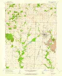
1961 Map of Appleton City
USGS Topo · Published 1962About this map
Appleton City serves as the primary hub of this west-central Missouri landscape at the start of the 1960s, where the Missouri Kansas Texas railroad line cuts a diagonal path through the prairie. The transition from agricultural use to industrial activity is evident in the east, where extensive strip mining operations border the town. These excavations contrast with the established rural infrastructure, such as the Hudson School and several family or community burial grounds including Fennewald Cemetery and Round Prairie Cemetery. The local hydrology is anchored by Appleton City Lake and the meandering Little Monegaw Creek, while the village of Hudson and the railroad siding at Lindale mark the smaller nodes of settlement. Cultural landmarks like the Mt Hope Community Center and Roadside Park reflect the social fabric of the townships during this era.
Find a feature on this map
24 named features on this map. Tap any name to fly to it.
Don’t see what you’re looking for? This feature index may not catch every label — zoom into the map to look around manually.
Map Details
Editions of this 1961 Appleton City Map
This is the sole edition of this map. No revisions or reprints were ever made.
Other maps of this area

1887 · Clinton
USGS Topo · 1:125,000

1887 · Butler
USGS Topo · 1:125,000

1894 · Butler
USGS Topo · 1:125,000

1894 · Clinton
USGS Topo · 1:125,000

1934 · Papinsville
USGS Topo · 1:24,000

1934 · Rockville
USGS Topo · 1:24,000

1938 · Taberville
USGS Topo · 1:24,000

1940 · Taberville
USGS Topo · 1:24,000

1947 · Jefferson City
USGS Topo · 1:250,000

1947 · Lawrence
USGS Topo · 1:250,000