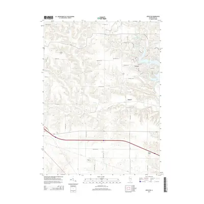
2015 Map of Appleton
USGS Topo · Published 2015About this map
The unincorporated settlement of Appleton sits at the heart of this Knox County landscape, where the agricultural grid meets the winding drainages of North Cr and Middle Cr. To the northeast, the residential development of Oak Run surrounds the irregular shoreline of Spoon Lake, a contrast to the traditional farmsteads defined by routes like Old Wagon Rd and Barefoot Rd. This map preserves the locations of several small burial grounds, including Westfall Cem, Van Gilder Cem, Myers Cem, and Russell Cem, which serve as vital markers for local family histories.
Find a feature on this map
49 named features on this map. Tap any name to fly to it.
Don’t see what you’re looking for? This feature index may not catch every label — zoom into the map to look around manually.
Map Details
Editions of this 2015 Appleton Map
This is the sole edition of this map. No revisions or reprints were ever made.
Other maps of this area

1925 · Galesburg
USGS Topo · 1:62,500

1927 · Galesburg
USGS Topo · 1:62,500

1931 · Galva
USGS Topo · 1:48,000

1940 · Galva
USGS Topo · 1:62,500

1941 · Maquon
USGS Topo · 1:62,500

1943 · Maquon
USGS Topo · 1:62,500

1944 · Galva
USGS Topo · 1:62,500

1947 · Woodhull
USGS Topo · 1:62,500

1958 · Burlington
USGS Topo · 1:250,000

1958 · Davenport
USGS Topo · 1:250,000