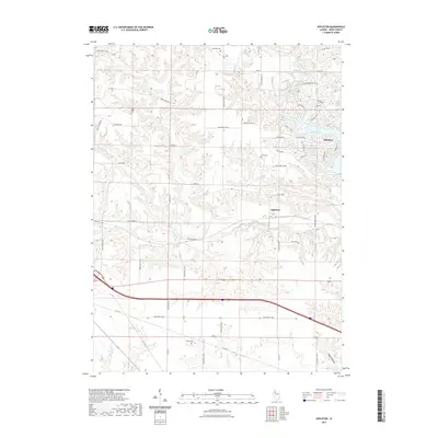
2021 Map of Appleton
USGS Topo · Published 2021About this map
Appleton anchors this portion of Knox County, where the agricultural landscape meets the residential and recreational development of Oak Run. The terrain is defined by the winding course of Middle Cr and its tributaries, which have carved numerous valleys and ridges into the prairie. To the northeast, the waters of Spoon Lake and Peterson Lake create a distinctive lakeside community structure, contrasting with the traditional grid of rural routes such as Old Wagon Rd. For those researching local family history, several burial grounds are preserved across the sections, including Westfall Cem, Van Gilder Cem, Myers Cem, and Russell Cem. This interplay of established farmsteads, small unincorporated communities, and modern water-focused developments illustrates the evolving land use in the Illinois heartland as it appeared in the early twenty-first century.
Find a feature on this map
53 named features on this map. Tap any name to fly to it.
Don’t see what you’re looking for? This feature index may not catch every label — zoom into the map to look around manually.
Map Details
Editions of this 2021 Appleton Map
This is the sole edition of this map. No revisions or reprints were ever made.
Other maps of this area

1925 · Galesburg
USGS Topo · 1:62,500

1927 · Galesburg
USGS Topo · 1:62,500

1931 · Galva
USGS Topo · 1:48,000

1940 · Galva
USGS Topo · 1:62,500

1941 · Maquon
USGS Topo · 1:62,500

1943 · Maquon
USGS Topo · 1:62,500

1944 · Galva
USGS Topo · 1:62,500

1947 · Woodhull
USGS Topo · 1:62,500

1958 · Burlington
USGS Topo · 1:250,000

1958 · Davenport
USGS Topo · 1:250,000