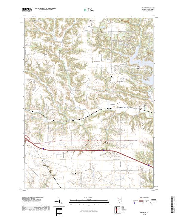
2024 Map of Appleton
USGS Topo · Published 2024About this map
The settlement of Appleton sits at the heart of this Knox County landscape, surrounded by a complex system of waterways and family-named cemeteries. To the northeast, the development around Oak Run and Spoon Lake stands in contrast to the rural agricultural patterns of the west, where names like Van Gilder Cem and Westfall Cem mark the heritage of early residents. The drainage of North Creek and Sugar Creek carves a winding path through the terrain, while the Interstate corridor provides a modern transit artery through the southern portion of the sheet.
Find a feature on this map
55 named features on this map. Tap any name to fly to it.
Don’t see what you’re looking for? This feature index may not catch every label — zoom into the map to look around manually.
Map Details
Editions of this 2024 Appleton Map
This is the sole edition of this map. No revisions or reprints were ever made.
Other maps of this area

1925 · Galesburg
USGS Topo · 1:62,500

1927 · Galesburg
USGS Topo · 1:62,500

1931 · Galva
USGS Topo · 1:48,000

1940 · Galva
USGS Topo · 1:62,500

1941 · Maquon
USGS Topo · 1:62,500

1943 · Maquon
USGS Topo · 1:62,500

1944 · Galva
USGS Topo · 1:62,500

1947 · Woodhull
USGS Topo · 1:62,500

1958 · Burlington
USGS Topo · 1:250,000

1958 · Davenport
USGS Topo · 1:250,000