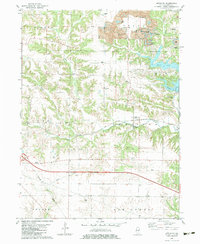
1982 Map of Appleton
USGS Topo · Published 1983About this map
Strip mines dominate the northeastern landscape of this Knox County quadrangle, where industrial excavations sit adjacent to recreational developments like Manson Heights Lake and Peterson Lake. The small settlement of Appleton serves as a central point along the Atchison Topeka and Santa Fe railroad, which cuts through Persifer township. Family history researchers will find several well-preserved burial grounds including Westfall Cem, Van Gilder Cem, and Russell Cem, alongside the local landmark of Maxey Chapel. The drainage of North Creek and Middle Creek defines the local topography, while the Burlington Northern line establishes a major transportation corridor across the southern half of the sheet, reflecting the region's long-standing reliance on rail infrastructure to move both agricultural and mineral products.
Find a feature on this map
33 named features on this map. Tap any name to fly to it.
Don’t see what you’re looking for? This feature index may not catch every label — zoom into the map to look around manually.
Map Details
Editions of this 1982 Appleton Map
This is the sole edition of this map. No revisions or reprints were ever made.
Other maps of this area

1925 · Galesburg
USGS Topo · 1:62,500

1927 · Galesburg
USGS Topo · 1:62,500

1931 · Galva
USGS Topo · 1:48,000

1940 · Galva
USGS Topo · 1:62,500

1941 · Maquon
USGS Topo · 1:62,500

1943 · Maquon
USGS Topo · 1:62,500

1944 · Galva
USGS Topo · 1:62,500

1947 · Woodhull
USGS Topo · 1:62,500

1958 · Burlington
USGS Topo · 1:250,000

1958 · Davenport
USGS Topo · 1:250,000