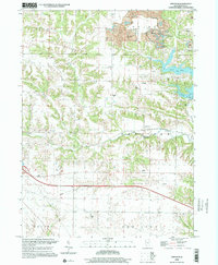
1998 Map of Appleton
USGS Topo · Published 2001About this map
Strip mines and industrial land use significantly altered the landscape of northeastern Knox County by the late 20th century, particularly around the Copley township line. These extractive activities created a distinct topography of pits and spoils, some of which were later reclaimed for recreational use, as seen with the development of Manson Heights Lake and the nearby Campground. In contrast to these heavy industrial markers, the southern half of the map retains a traditional rural character, anchored by the namesake settlement of Appleton along Court Creek.
Find a feature on this map
30 named features on this map. Tap any name to fly to it.
Don’t see what you’re looking for? This feature index may not catch every label — zoom into the map to look around manually.
Map Details
Editions of this 1998 Appleton Map
This is the sole edition of this map. No revisions or reprints were ever made.
Other maps of this area

1925 · Galesburg
USGS Topo · 1:62,500

1927 · Galesburg
USGS Topo · 1:62,500

1931 · Galva
USGS Topo · 1:48,000

1940 · Galva
USGS Topo · 1:62,500

1941 · Maquon
USGS Topo · 1:62,500

1943 · Maquon
USGS Topo · 1:62,500

1944 · Galva
USGS Topo · 1:62,500

1947 · Woodhull
USGS Topo · 1:62,500

1958 · Burlington
USGS Topo · 1:250,000

1958 · Davenport
USGS Topo · 1:250,000