
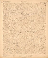
1921 Map of Appling
USGS Topo · Published 1921About this map
The Savannah River and Little River define the winding northern and central boundaries of this 1921 portrait of Columbia County. The landscape is an intricate network of local crossroads and community hubs, with Appling serving as a central point for the region's transport along the Augusta Road. Transport across the rivers remained reliant on local crossings such as Lockhart Ferry and the Raysville Bridge, reflecting a time before modern dam projects altered these waterways.
Find a feature on this map
98 named features on this map. Tap any name to fly to it.
Don’t see what you’re looking for? This feature index may not catch every label — zoom into the map to look around manually.
Map Details
Editions of this 1921 Appling Map
3 editions found
Other maps of this area

1892 · Mc Cormick
USGS Topo · 1:125,000

1906 · Crawfordville
USGS Topo · 1:125,000

1912 · Mc Cormick
USGS Topo · 1:125,000

1920 · Clarks Hill
USGS Topo · 1:48,000

1921 · Clarks Hill
USGS Topo · 1:62,500

1922 · Harlem
USGS Topo · 1:62,500

1922 · Hephzibah
USGS Topo · 1:62,500

1941 · Clarks Hill
USGS Topo · 1:62,500

1942 · Clarks Hill
USGS Topo · 1:62,500

1943 · Appling
USGS Topo · 1:62,500