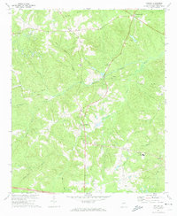
1971 Map of Appling
USGS Topo · Published 1974About this map
Appling serves as a central hub in this early 1970s landscape, which is defined by a dense network of rural churches and family-named watercourses. The area's spiritual and social history is deeply anchored by sites like Kiokee Ch and the Old Kiokee Ch Cem, alongside other congregations such as Mt Moriah Ch and Olive Grove Ch. These institutions are dispersed among small settlements including Phinizy, Howell, and Pollards Corner, reflecting a traditional Georgia Piedmont community structure.
Find a feature on this map
28 named features on this map. Tap any name to fly to it.
Don’t see what you’re looking for? This feature index may not catch every label — zoom into the map to look around manually.
Map Details
Editions of this 1971 Appling Map
2 editions found
Other maps of this area

1892 · Mc Cormick
USGS Topo · 1:125,000

1912 · Mc Cormick
USGS Topo · 1:125,000

1920 · Clarks Hill
USGS Topo · 1:48,000

1921 · Clarks Hill
USGS Topo · 1:62,500

1921 · Appling
USGS Topo · 1:62,500

1922 · Harlem
USGS Topo · 1:62,500

1922 · Hephzibah
USGS Topo · 1:62,500

1941 · Clarks Hill
USGS Topo · 1:62,500

1942 · Clarks Hill
USGS Topo · 1:62,500

1943 · Appling
USGS Topo · 1:62,500