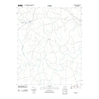
2010 Map of Aquadale
USGS Topo · Published 2010About this map
The Rocky River and Richardson Creek systems define this landscape in Stanly County, where a network of rural routes connects the communities of Aquadale and Cottonville. The terrain is marked by significant hydrological management, including the Long Branch Reservoir and its associated Long Branch Reservoir Dam, as well as the Stump Pond Dam. Local roads frequently carry family and place names that hint at the region's agricultural and social history, such as Rocky River Springs Rd, S Stanly School Rd, and Gaddy's Ferry Rd.
Find a feature on this map
71 named features on this map. Tap any name to fly to it.
Don’t see what you’re looking for? This feature index may not catch every label — zoom into the map to look around manually.
Map Details
Editions of this 2010 Aquadale Map
This is the sole edition of this map. No revisions or reprints were ever made.
Other maps of this area

1953 · Charlotte
USGS Topo · 1:250,000

1954 · Charlotte
USGS Topo · 1:250,000

1956 · Ansonville
USGS Topo · 1:24,000

1956 · Mount Gilead West
USGS Topo · 1:24,000

1957 · Mount Pleasant
USGS Topo · 1:62,500

1957 · Albemarle
USGS Topo · 1:62,500

1960 · Charlotte
USGS Topo · 1:250,000

1962 · Charlotte
USGS Topo · 1:250,000
1970 · Polkton
USGS Topo · 1:24,000
1970 · Olive Branch
USGS Topo · 1:24,000