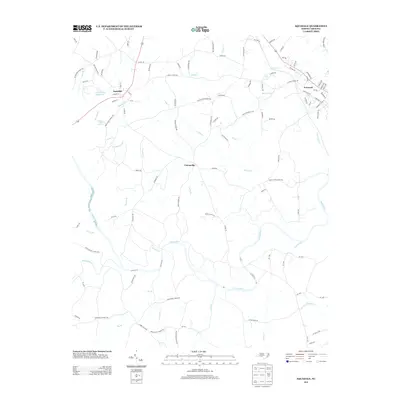
2013 Map of Aquadale
USGS Topo · Published 2013About this map
Rocky River winds through the heart of this Stanly County landscape, defining the topography between the settlements of Aquadale, Cottonville, and the western edge of Norwood. The terrain is deeply etched by a network of named watercourses, including the curiously named S Ugly Cr and Ugly Cr, alongside Alligator Br and Stillhouse Br. These names often point toward the historical utility of the land, from early whiskey production to local landmarks like Rocky River Springs.
Find a feature on this map
98 named features on this map. Tap any name to fly to it.
Don’t see what you’re looking for? This feature index may not catch every label — zoom into the map to look around manually.
Map Details
Editions of this 2013 Aquadale Map
This is the sole edition of this map. No revisions or reprints were ever made.
Other maps of this area

1953 · Charlotte
USGS Topo · 1:250,000

1954 · Charlotte
USGS Topo · 1:250,000

1956 · Ansonville
USGS Topo · 1:24,000

1956 · Mount Gilead West
USGS Topo · 1:24,000

1957 · Mount Pleasant
USGS Topo · 1:62,500

1957 · Albemarle
USGS Topo · 1:62,500

1960 · Charlotte
USGS Topo · 1:250,000

1962 · Charlotte
USGS Topo · 1:250,000
1970 · Polkton
USGS Topo · 1:24,000
1970 · Olive Branch
USGS Topo · 1:24,000