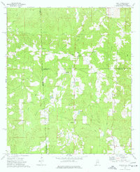
1974 Map of Aquilla
USGS Topo · Published 1977About this map
Aquilla sits at the heart of this mid-1970s landscape, positioned near the intersection of several tributary networks. The area is defined by the Alabama-Mississippi state line and the meeting of Choctaw and Washington counties. The terrain is deeply carved by drainage systems like Turkey Creek, Sandy Creek, and Red Creek, which dictate the placement of small rural communities and centers of worship. Religious and social life is anchored by numerous country churches, including Kings Chapel, New Rock Church, and Shady Grove Church. Small-scale industry and infrastructure appear in the form of a Sandpit and the Aquilla Lookout Tower, while local landmarks like Lake Gypsy and Lake Ola provide focal points in the woodland. Notable for genealogists, the map preserves the locations of several burial grounds, such as Old Aquilla Cemetery and Wilkins Cemetery, which are often difficult to locate in modern contexts.
Find a feature on this map
33 named features on this map. Tap any name to fly to it.
Don’t see what you’re looking for? This feature index may not catch every label — zoom into the map to look around manually.
Map Details
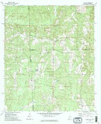
Editions of this 1974 Aquilla Map
2 editions found
Other maps of this area

1953 · Hattiesburg
USGS Topo · 1:250,000

1958 · Hattiesburg
USGS Topo · 1:250,000

1964 · Denham
USGS Topo · 1:24,000

1964 · Buckatunna
USGS Topo · 1:24,000

1964 · Matherville
USGS Topo · 1:24,000

1974 · Millry South
USGS Topo · 1:24,000

1974 · Millry North
USGS Topo · 1:24,000

1974 · Silas
USGS Topo · 1:24,000

1974 · Copeland
USGS Topo · 1:24,000

1974 · Isney
USGS Topo · 1:24,000