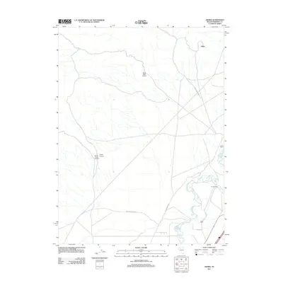
2011 Map of Arabia
USGS Topo · Published 2011About this map
The Arabia district of Pershing County unfolds across this high-desert landscape, dominated by the winding course of the Humboldt River in the southeast. This 2011 survey documents a region where ranching and historical transit routes intersect. Significant topographic features like Black Rock Canyon, Trinity Canyon, and South Trinity Canyon define the western elevations, while the valley floor supports agricultural outposts such as Salinas Ranch and Young Ranch. The inclusion of Old Emigrant Rd and Poker Browncamp Rd highlights the enduring legacy of early Nevada travel corridors. Near the river, the Young Dam serves as a critical point of water management in an otherwise arid basin. This map provides a clear record of land use and named ranching landmarks within the Great Basin, useful for understanding the modern footprint of these long-established desert settlements.
Find a feature on this map
12 named features on this map. Tap any name to fly to it.
Don’t see what you’re looking for? This feature index may not catch every label — zoom into the map to look around manually.
Map Details
Editions of this 2011 Arabia Map
This is the sole edition of this map. No revisions or reprints were ever made.
Other maps of this area

1931 · Lovelock
USGS Topo · 1:250,000

1935 · Lovelock
USGS Topo · 1:250,000

1955 · Lovelock
USGS Topo · 1:250,000

1956 · Oreana
USGS Topo · 1:62,500

1956 · Toulon
USGS Topo · 1:62,500

1956 · Lovelock
USGS Topo · 1:62,500

1959 · Lovelock
USGS Topo · 1:250,000

1981 · Natchez Spring
USGS Topo · 1:24,000

1981 · Poker Brown Spring
USGS Topo · 1:24,000

1984 · Lovelock
USGS Topo · 1:100,000