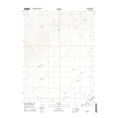
2014 Map of Arabia
USGS Topo · Published 2014About this map
Arabia sits atop the high ground of Pershing County, marking a landscape defined by the sharp transition between the rugged heights of Trinity Canyon and the low-lying agricultural plains of the Upper Valley. To the east, the Humboldt River and the Taylor Canal provide the essential water network for this arid region, supporting ranching operations accessed by routes like Wolf Creek Ranch Rd and Shearer Ranch RD. Historical transit is etched into the terrain via the Old Emigrant Rd, which skirts the base of the mountains near the small settlement of Colado. The map details a complex system of canyons, including South Trinity Canyon and Black Rock Canyon, which drain toward the river valley, illustrating the precarious balance of water and geography that has shaped Nevada's high desert development.
Find a feature on this map
22 named features on this map. Tap any name to fly to it.
Don’t see what you’re looking for? This feature index may not catch every label — zoom into the map to look around manually.
Map Details
Editions of this 2014 Arabia Map
This is the sole edition of this map. No revisions or reprints were ever made.
Other maps of this area

1931 · Lovelock
USGS Topo · 1:250,000

1935 · Lovelock
USGS Topo · 1:250,000

1955 · Lovelock
USGS Topo · 1:250,000

1956 · Oreana
USGS Topo · 1:62,500

1956 · Toulon
USGS Topo · 1:62,500

1956 · Lovelock
USGS Topo · 1:62,500

1959 · Lovelock
USGS Topo · 1:250,000

1981 · Natchez Spring
USGS Topo · 1:24,000

1981 · Poker Brown Spring
USGS Topo · 1:24,000

1984 · Lovelock
USGS Topo · 1:100,000