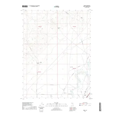
2018 Map of Arabia
USGS Topo · Published 2018About this map
The Humboldt River and its accompanying riparian wetlands dominate the southeastern corner of this Pershing County landscape, where the Taylor Canal and Upper Valley irrigation infrastructure support local agriculture. The terrain shifts dramatically to the west as the floor rises into the steep slopes of Trinity Canyon and South Trinity Canyon. Historic transport routes like the Old Emigrant Rd trace the path of earlier migrations through this arid region, while modern ranching operations are noted by labels such as Wolf Creek Ranch Rd and Shearer Ranch Rd. The settlement of Arabia sits in the northeastern hills, while Colado provides a point of reference along the southern transit corridor. A network of primitive roads, including Poker Brown Camp Rd, reaches into more isolated areas like Black Rock Canyon, illustrating the modern management of these traditional ranching and mining lands.
Find a feature on this map
25 named features on this map. Tap any name to fly to it.
Don’t see what you’re looking for? This feature index may not catch every label — zoom into the map to look around manually.
Map Details
Editions of this 2018 Arabia Map
This is the sole edition of this map. No revisions or reprints were ever made.
Other maps of this area

1931 · Lovelock
USGS Topo · 1:250,000

1935 · Lovelock
USGS Topo · 1:250,000

1955 · Lovelock
USGS Topo · 1:250,000

1956 · Oreana
USGS Topo · 1:62,500

1956 · Toulon
USGS Topo · 1:62,500

1956 · Lovelock
USGS Topo · 1:62,500

1959 · Lovelock
USGS Topo · 1:250,000

1981 · Natchez Spring
USGS Topo · 1:24,000

1981 · Poker Brown Spring
USGS Topo · 1:24,000

1984 · Lovelock
USGS Topo · 1:100,000