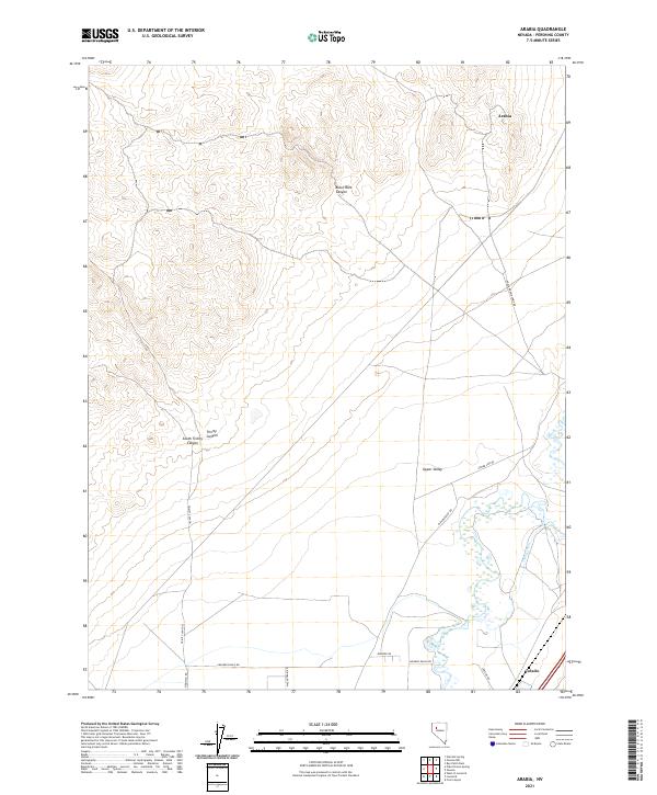
2021 Map of Arabia
USGS Topo · Published 2021About this map
Arabia sits atop the high desert terrain of Pershing County, Nevada, where the West Humboldt Range transitions into the expansive basins below. This 2021 survey illustrates a landscape defined by its rugged topography and sparse water resources, centered around prominent geological features like Black Rock Canyon and the winding Trinity Canyon. The presence of the Young Canal and Upper Valley suggests the persistent efforts to manage water in this arid environment, while the tiny settlement of Colado anchors the southern boundary near the rail and utility corridors.
Find a feature on this map
19 named features on this map. Tap any name to fly to it.
Don’t see what you’re looking for? This feature index may not catch every label — zoom into the map to look around manually.
Map Details
Editions of this 2021 Arabia Map
This is the sole edition of this map. No revisions or reprints were ever made.
Other maps of this area

1931 · Lovelock
USGS Topo · 1:250,000

1935 · Lovelock
USGS Topo · 1:250,000

1955 · Lovelock
USGS Topo · 1:250,000

1956 · Oreana
USGS Topo · 1:62,500

1956 · Toulon
USGS Topo · 1:62,500

1956 · Lovelock
USGS Topo · 1:62,500

1959 · Lovelock
USGS Topo · 1:250,000

1981 · Natchez Spring
USGS Topo · 1:24,000

1981 · Poker Brown Spring
USGS Topo · 1:24,000

1984 · Lovelock
USGS Topo · 1:100,000