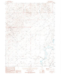
1987 Map of Arabia
USGS Topo · Published 1988About this map
Mining operations dominated the eastern slopes of the Trinity Range in the 1980s, where several named claims and shafts suggest a long history of silver and lead extraction. High-elevation sites like the Jersey Mine and the Montezuma Mine overlook the desert flats, while the Lucky Boy Mine and Morning Star Mine cluster further south along the range. This landscape transitions sharply from the rocky terrain of South Trinity Canyon to the alluvial floor of the Upper Valley.
Find a feature on this map
25 named features on this map. Tap any name to fly to it.
Don’t see what you’re looking for? This feature index may not catch every label — zoom into the map to look around manually.
Map Details
Editions of this 1987 Arabia Map
This is the sole edition of this map. No revisions or reprints were ever made.
Other maps of this area

1931 · Lovelock
USGS Topo · 1:250,000

1935 · Lovelock
USGS Topo · 1:250,000

1955 · Lovelock
USGS Topo · 1:250,000

1956 · Oreana
USGS Topo · 1:62,500

1956 · Toulon
USGS Topo · 1:62,500

1956 · Lovelock
USGS Topo · 1:62,500

1959 · Lovelock
USGS Topo · 1:250,000

1981 · Natchez Spring
USGS Topo · 1:24,000

1981 · Poker Brown Spring
USGS Topo · 1:24,000

1984 · Lovelock
USGS Topo · 1:100,000