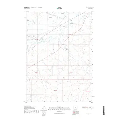
2017 Map of Arapahoe
USGS Topo · Published 2017About this map
Saint Stephens and Arapahoe anchor this landscape in Fremont County, where the Little Wind River weaves through a network of irrigation and water management features. The area's complex human geography is visible in its numerous cemeteries, including the Fort Washakie Post Cem, Arapahoe Cem, and Arapahoe Catholic Cem. Water distribution is central to the land's utility, marked by engineered waterways like the Sub-Agency Ditch, Lefthand Ditch, and Mission Ditch, which parallel the natural courses of Beaver Creek and Double Ditch. In the southern portion of the quadrangle, the terrain transitions into the more arid stretches of Preacher Draw and Sand Gulch, while the Gustin Number 2 Reservoir provides a critical collection point for the region's managed water supply. A grid of rural roads like 17 Mile Rd and Rendezvous Rd connects these scattered settlements and spiritual sites.
Find a feature on this map
34 named features on this map. Tap any name to fly to it.
Don’t see what you’re looking for? This feature index may not catch every label — zoom into the map to look around manually.
Map Details
Editions of this 2017 Arapahoe Map
This is the sole edition of this map. No revisions or reprints were ever made.
Other maps of this area

1950 · Riverton East
USGS Topo · 1:24,000

1951 · Pavillion SE
USGS Topo · 1:24,000

1951 · Riverton West
USGS Topo · 1:24,000

1952 · Hudson
USGS Topo · 1:24,000

1952 · Lander SE
USGS Topo · 1:24,000

1953 · Arapahoe NE
USGS Topo · 1:24,000

1953 · Ninemile Hill
USGS Topo · 1:24,000

1953 · Bringolf Ranch
USGS Topo · 1:24,000

1953 · Arapahoe
USGS Topo · 1:24,000

1955 · Thermopolis
USGS Topo · 1:250,000