
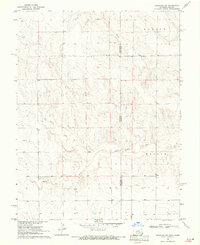
1969 Map of Arapahoe SE
USGS Topo · Published 1971About this map
The high plains borderland between Colorado and Kansas is defined by the incision of Ladder Creek as it winds through the arid terrain. Surveyed in the late 1960s, this map captures a landscape transitioning between the open rangeland of Cheyenne and Wallace Counties and the infrastructure of the central plains. The northern portion of the sheet is dominated by the strategic corridor of the Union Pacific railroad, which runs parallel to the sectional boundaries that carved the frontier into the Homestead-era grid. This transportation artery provided the primary link for the scattered agricultural interests in this dry region.
Find a feature on this map
5 named features on this map. Tap any name to fly to it.
Don’t see what you’re looking for? This feature index may not catch every label — zoom into the map to look around manually.
Map Details
Editions of this 1969 Arapahoe SE Map
This is the sole edition of this map. No revisions or reprints were ever made.
Other maps of this area

1892 · Cheyenne Wells
USGS Topo · 1:125,000

1894 · Cheyenne Wells
USGS Topo · 1:125,000

1954 · Lamar
USGS Topo · 1:250,000

1955 · Scott City
USGS Topo · 1:250,000

1958 · Lamar
USGS Topo · 1:250,000

1958 · Scott City
USGS Topo · 1:250,000

1959 · Weskan
USGS Topo · 1:62,500

1968 · Sharon Springs 3 NW
USGS Topo · 1:24,000

1969 · Cheyenne Wells 4 NE
USGS Topo · 1:24,000
1969 · Arapahoe NE
USGS Topo · 1:24,000