Old Maps of Cheyenne County, Colorado
Explore 315 old maps of Cheyenne County, spanning from 1891 to today. These high-resolution historic maps reveal how streets, neighborhoods, landmarks, and natural features evolved over time — perfect for genealogy, metal detecting, research, and local history exploration.
What you can do with these maps:
- See how Cheyenne County changed over time: Compare historical maps to modern-day views to trace roads, homesites, rail lines & more.
- View detailed metadata: Each map includes creators, publishers, year, scale, and archive source.
- Overlay maps with satellite & LiDAR: Visualize the past alongside modern tools to explore terrain & human change.
- Trusted historical sources: Maps sourced from the USGS, Library of Congress, and other archives.
- Access maps your way: View online, download high-res files, or order prints for personal or research use.
Start exploring old maps of Cheyenne County to uncover forgotten places, hidden landmarks, and the deep history beneath your feet.
Cheyenne County, CO maps
(315)- 1891 Map of Arroyo
 1891 Arroyo1891 Print · USGSEastern Colorado was still a ranching frontier in the late 1880s as the rail lines expanded across the high plains. Genealogists and historians can trace early holdings like Cox Ranch and Mosley Ranch along the route of the Union Pacific Railroad.
 - 1891 Map of Kit Carson
 1891 Kit Carson1891 Print · USGSThe eastern Colorado plains appear here in the late nineteenth century as a landscape defined by the arrival of the rails. Researchers can trace the early path of the Union Pacific Railroad through the stations at Kit Carson, Wild Horse, and First View.
 - 1892 Map of Cheyenne Wells
 1892 Cheyenne Wells1892 Print · USGSEastern Colorado during the early frontier era is documented here as the railroad transformed the High Plains. Genealogists and historians can trace the vital iron link of the Union Pacific Railroad through settlements like Cheyenne Wells and Arapahoe.
 - 1893 Map of Arroyo
 1893 Arroyo1893 Print · USGSEastern Colorado was a landscape of isolated cattle ranches and railway outposts during the late nineteenth century. Researchers can locate early family homesteads like Cox Ranch and follow the route of the Union Pacific Railroad through Bovero.4 unique versions available
 - 1893 Map of Kit Carson
 1893 Kit Carson1893 Print · USGSEastern Colorado during the late nineteenth century was a landscape shaped by rail and river. You can trace the early path of the Union Pacific Railroad through Kit Carson and locate the stations at Wild Horse and First View.5 unique versions available
 - 1894 Map of Cheyenne Wells
 1894 Cheyenne Wells1894 Print · USGSEastern Colorado in the late nineteenth century is a landscape of expansive ranchland defined by the Union Pacific Railroad. Researchers can trace early railroad settlements like Cheyenne Wells and Arapahoe or follow the courses of Ladder Creek and White Woman Creek.6 unique versions available
 - 1954 Map of Limon
 1954 Limon1954 Print · USGSThe Eastern Colorado plains and the Kansas borderlands come alive in the mid-fifties, showing the vital rail-and-road corridor through Limon. Genealogists and historians can trace the Chicago Rock Island & Pacific line through Burlington and find remote outposts like Arickaree and Anton.4 unique versions available
 - 1954 Map of Lamar, 1964 Print
 1954 Lamar1964 Print · USGSSoutheastern Colorado and the Kansas borderlands appear here in the mid-fifties, dominated by the vital Arkansas River irrigation network. Researchers can trace the development of river towns like Lamar and La Junta alongside the Amity Cemetery and several major reservoirs.3 unique versions available
 - 1957 Map of Limon
 1957 Limon1957 Print · USGSThe High Plains of Eastern Colorado and Western Kansas come alive in the mid-1950s, showing the vital rail-and-road connections of the era. You can trace the path of the Chicago Rock Island and Pacific through towns like Limon, Stratton, and Burlington or find the early footprint of Bonny Reservoir.
 - 1958 Map of Limon
 1958 Limon1958 Print · USGSEastern Colorado and the Kansas border meet in this late-fifties study of High Plains rail and river systems. Researchers can trace the path of the Chicago Rock Island and Pacific through Limon and Burlington, or locate the Bonny Dam and Bonny Reservoir.
 - 1958 Map of Lamar
 1958 Lamar1958 Print · USGSThe High Plains of Eastern Colorado and Western Kansas in the late fifties reveal a landscape tied to the Arkansas River and the rails. Trace the heritage of the river valley through Fort Lyon, the Atchison Topeka and Santa Fe RR, and rural landmarks like Kendrick Church.2 unique versions available
 - 1969 Map of Arapahoe SE, 1971 Print
 1969 Arapahoe SE1971 Print · USGSThe high plains of the Colorado-Kansas border come into focus in the late sixties, highlighting the vital rail corridor of the Union Pacific. Researchers can trace the path of Ladder Creek and locate numerous family ranch assets including scattered Well sites and surveyed fence lines.
 - 1969 Map of Cheyenne Wells 4 NE, 1971 Print
 1969 Cheyenne Wells 4 NE1971 Print · USGSThe Colorado and Kansas borderlands meet in the late sixties along the winding path of South Ladder Creek. Genealogists and researchers can trace township boundaries and find family-named landmarks like Wells or the remote Colony and Weskan districts.3 unique versions available
 - 1969 Map of Cheyenne Wells 4 SE, 1971 Print
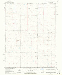 1969 Cheyenne Wells 4 SE1971 Print · USGSHigh plains life at the Colorado and Kansas border is captured here during the late sixties. Genealogists and local historians can trace the rural landscape near Colony, locating the local Cem and the winding path of White Woman Creek.3 unique versions available
 - 1969 Map of Arapahoe NE, 1971 Print
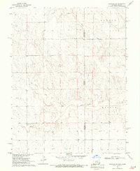 1969 Arapahoe NE1971 Print · USGSThe High Plains of the Colorado-Kansas border come into focus in the late sixties, where the Smoky Hill River defines the landscape. Genealogists and researchers can trace early water sources like Wells and the terrain of Morton and Weskan.
 - 1969 Map of Mount Sunflower SW, 1972 Print
 1969 Mount Sunflower SW1972 Print · USGSHigh plains ranching along the Kansas border comes into focus in the late sixties. Researchers can trace the North Fork Smoky Hill River and locate remote outposts like Beverage Ranch and the Monotony terrain.
 - 1969 Map of Burlington 3 SE, 1972 Print
 1969 Burlington 3 SE1972 Print · USGSThe eastern Colorado plains meet the high prairie in the late sixties, where the North Fork Smoky Hill River carves its way through the borderlands. Researchers can trace the section lines across Kit Carson Co and Cheyenne Co to locate numerous named wells and rural roads.5 unique versions available
 - 1969 Map of Mount Sunflower, 1972 Print
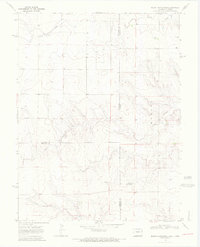 1969 Mount Sunflower1972 Print · USGSThe High Plains border of Colorado and Kansas comes into focus in this late 1960s survey. Genealogists and historians can locate the highest point in Kansas at Mount Sunflower and trace the sparse prairie settlements like Hitchcock and the drainages of Goose Creek.2 unique versions available
 - 1969 Map of Alpine Ranch, 1972 Print
 1969 Alpine Ranch1972 Print · USGSThe eastern Colorado plains at the boundary of Kit Carson and Cheyenne Counties are captured here just before the 1970s. Researchers can trace rural landmarks like Alpine Ranch, the settlement at Perry, and numerous Well sites along the North Fork Smoky Hill River.
 - 1969 Map of Burlington 3 SW, 1972 Print
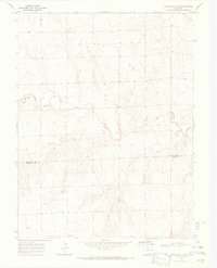 1969 Burlington 3 SW1972 Print · USGSEastern Colorado ranching country is documented here in the late sixties, where the border of Kit Carson Co and Cheyenne Co meets. Genealogists and researchers can trace the North Fork Smoky Hill River and locate landmarks like Windrift Ranch and several rural wells.5 unique versions available
 - 1978 Map of Galatea NE
 1978 Galatea NE1978 Print · USGSCheyenne County ranching lands are captured in the late 1970s, showing a landscape defined by water scarcity and open range. Researchers can trace the named settlement of Jacobs and the crucial water infrastructure of Rush Creek and various Wells.
 - 1978 Map of Aroya
 1978 Aroya1978 Print · USGSLincoln County ranching and rail transport converge in the late 1970s along the Union Pacific line. Researchers can trace the layout of the Aroya settlement and find family landmarks like Rush Creek Ranch or the local Cem.
 - 1978 Map of Galatea SW
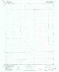 1978 Galatea SW1978 Print · USGSThe high plains of eastern Colorado meet in the late seventies at a unique juncture of three counties. Genealogists and land researchers can trace the intersection of Lincoln Co Kiowa Co and Lincoln Co Cheyenne Co, locating remote landmarks like Well and BM 4575.
 - 1978 Map of Sanders Ranch
 1978 Sanders Ranch1978 Print · USGSCheyenne County ranching lands are captured here in the late seventies, showing the sparse but vital water networks of the high plains. Genealogists and local historians can locate the isolated Grave and trace the cattle operations around Sanders Ranch and Adobe Gulch.
 - 1978 Map of Stacy Lakes Draw
 1978 Stacy Lakes Draw1978 Print · USGSThe Colorado high plains near the Lincoln and Cheyenne county line are captured here in the late seventies. Genealogists and historians can trace the specific locations of Brown Mill Ranch, the settlement at Trade, and local water sources like Stacy Spring.
Showing maps 1-25 of 315
Top cities of Cheyenne County
Frequently asked questions
- What are the different types of historical maps available for Cheyenne County?
- What is the oldest map of Cheyenne County?
- Where can I purchase historical maps of Cheyenne County for my home or office?
- Where can I download high-res historical maps of Cheyenne County?
- Are there historical topographic maps available for Cheyenne County?
- Is there historical aerial imagery available for Cheyenne County?
- Where are historical maps of Cheyenne County sourced from?