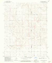
1969 Map of Arapahoe NE
USGS Topo · Published 1971About this map
The Smoky Hill River winds across the High Plains of the Colorado-Kansas border, serving as the defining geographic feature of this arid landscape. This 1969 field-checked survey highlights the convergence of several major drainage systems, including Willow Creek and Big Timber Creek, which cut through the open rangeland of Morton and Weskan. The map reveals the critical reliance on groundwater in this region, marking individual points such as Well and Wells that sustained local agricultural efforts and early settlement. The straight-line boundary between Colorado and Kansas divides the map, illustrating how political lines often bisect natural features like the river valley. The survey provides a clear view of the section-line road network that began to structure the territory as township and range divisions were formally established.
Find a feature on this map
9 named features on this map. Tap any name to fly to it.
Don’t see what you’re looking for? This feature index may not catch every label — zoom into the map to look around manually.
Map Details
Editions of this 1969 Arapahoe NE Map
This is the sole edition of this map. No revisions or reprints were ever made.
Other maps of this area

1892 · Cheyenne Wells
USGS Topo · 1:125,000

1894 · Cheyenne Wells
USGS Topo · 1:125,000

1954 · Limon
USGS Topo · 1:250,000

1954 · Lamar
USGS Topo · 1:250,000

1954 · Goodland
USGS Topo · 1:250,000

1955 · Scott City
USGS Topo · 1:250,000

1956 · Goodland
USGS Topo · 1:250,000

1957 · Limon
USGS Topo · 1:250,000

1957 · Goodland
USGS Topo · 1:250,000

1958 · Limon
USGS Topo · 1:250,000