1970s Maps of Cheyenne County, Colorado
Explore 13 historic maps of Cheyenne County from the 1970s. These maps offer a rare glimpse into what life looked like during the 1970s — showing old roads, neighborhoods, homes, and landmarks that have changed or disappeared over time.
Whether you're researching your family's past, planning a metal detecting trip, or studying how Cheyenne County's landscape evolved across the 1970s, these high-resolution maps are a powerful tool for exploring the history of this region.
- Focus on a specific era: All maps on this page are from the 1970s, giving you a focused view of this time period.
- See what’s changed: Compare century-old streets, trails, and buildings to today's modern landscape using overlays and satellite layers.
- Research with precision: Use these maps for genealogy, historical research, land use analysis, or educational projects.
- View, download, or print: Maps are fully viewable online in high resolution, and can be downloaded or printed for your own records.
Start exploring Cheyenne County's history through authentic maps from the 1970s. This is your window into the past.
Cheyenne County, CO maps
(13)- 1978 Map of Galatea NE
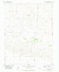
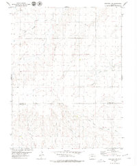
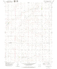
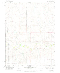 1978 Galatea NE1978 Print · USGSCheyenne County ranching lands are captured in the late 1970s, showing a landscape defined by water scarcity and open range. Researchers can trace the named settlement of Jacobs and the crucial water infrastructure of Rush Creek and various Wells.
 - 1978 Map of Aroya
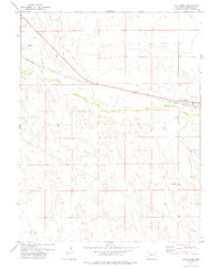
 1978 Aroya1978 Print · USGSLincoln County ranching and rail transport converge in the late 1970s along the Union Pacific line. Researchers can trace the layout of the Aroya settlement and find family landmarks like Rush Creek Ranch or the local Cem.
 - 1978 Map of Galatea SW
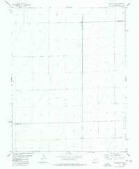 1978 Galatea SW1978 Print · USGSThe high plains of eastern Colorado meet in the late seventies at a unique juncture of three counties. Genealogists and land researchers can trace the intersection of Lincoln Co Kiowa Co and Lincoln Co Cheyenne Co, locating remote landmarks like Well and BM 4575.
 - 1978 Map of Sanders Ranch
 1978 Sanders Ranch1978 Print · USGSCheyenne County ranching lands are captured here in the late seventies, showing the sparse but vital water networks of the high plains. Genealogists and local historians can locate the isolated Grave and trace the cattle operations around Sanders Ranch and Adobe Gulch.
 - 1978 Map of Stacy Lakes Draw
 1978 Stacy Lakes Draw1978 Print · USGSThe Colorado high plains near the Lincoln and Cheyenne county line are captured here in the late seventies. Genealogists and historians can trace the specific locations of Brown Mill Ranch, the settlement at Trade, and local water sources like Stacy Spring.
 - 1978 Map of Wild Horse
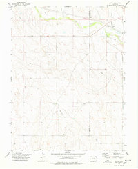
 1978 Wild Horse1978 Print · USGSThe high plains of Cheyenne County are captured in the late 1970s, focused on the railroad corridor and the Big Sandy Creek valley. Genealogists and historians can locate the Wild Horse Cem and trace the original Union Pacific rail lines and local Landing Strips.
 - 1978 Map of Galatea
 1978 Galatea1978 Print · USGSKiowa County during the late 1970s reveals a quiet agricultural landscape centered on the Missouri Pacific railroad. Genealogists and historians can locate the community of Galatea, the local Cem, and rural water features like Red Lake.
 - 1978 Map of Schafer Reservoir
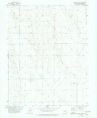
 1978 Schafer Reservoir1978 Print · USGSThe Eastern Plains of Colorado in the late 1970s are shown here as a vast network of drainage gulches and rail lines. Genealogists and historians can locate a remote Grave or trace the Union Pacific line as it follows Big Sandy Creek.
 - 1979 Map of Stratton 3 SE
 1979 Stratton 3 SE1979 Print · USGSThe eastern Colorado high plains are captured here in the late 1970s, showcasing the transition between Kit Carson and Cheyenne counties. Researchers can trace the intricate network of prairie waterways including Landsman Creek and Little Spring Creek, alongside rural points like Duncan and Mills.2 unique versions available
 - 1979 Map of Hugo 4 SE
 1979 Hugo 4 SE1979 Print · USGSThe high plains of eastern Colorado are captured here in the late 1970s along the Kit Carson and Cheyenne county line. Historians can trace the drainage of Bellyache Creek and Sand Creek past isolated landmarks like Well and Spring sites.2 unique versions available
 - 1979 Map of Stratton 3 SW
 1979 Stratton 3 SW1979 Print · USGSEastern Colorado ranchlands are captured here in the late seventies, showing the open country along the Kit Carson and Cheyenne county line. Researchers can trace the courses of East Branch Spring Creek and Big Spring Creek or locate local Springs.3 unique versions available
 - 1979 Map of Bledsoe Ranch
 1979 Bledsoe Ranch1979 Print · USGSThe high plains of eastern Colorado come into focus in the late 1970s at the junction of Lincoln, Kit Carson, and Cheyenne counties. Researchers can trace the drainage patterns of Sand Creek and Wild Horse Creek or locate local landmarks like Bledsoe Ranch and the Overland site.2 unique versions available
 - 1979 Map of Alpine Ranch SW
 1979 Alpine Ranch SW1979 Print · USGSThe High Plains of eastern Colorado in the late 1970s reveal a landscape defined by ranching and rural boundaries. Genealogists and researchers can trace the dividing line between Kit Carson Co and Cheyenne Co or locate water sources like South Fork Landsman Creek and the North Fork Smoky Hill River.
End of results
Showing maps 1-13 of 13
Top cities of Cheyenne County
Frequently asked questions
- What are the different types of historical maps available for Cheyenne County?
- What is the oldest map of Cheyenne County?
- Where can I purchase historical maps of Cheyenne County for my home or office?
- Where can I download high-res historical maps of Cheyenne County?
- Are there historical topographic maps available for Cheyenne County?
- Is there historical aerial imagery available for Cheyenne County?
- Where are historical maps of Cheyenne County sourced from?