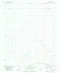
1978 Map of Galatea
USGS Topo · Published 1978About this map
Galatea sits along the southern edge of this Eastern Colorado landscape, defined by the path of the Missouri Pacific railroad. The settlement serves as the primary hub of human activity in an area otherwise characterized by vast stretches of open land dotted with agricultural markers and water management features. Evidence of early land use is found at the Cem and various locations marked simply as Well, including those situated near Red Lake and Carson Lake. These water bodies are distinctive landmarks in the high plains environment, providing critical resources for the local ranching and farming operations indicated by the network of section lines and fence markers. The map also records the boundary between Cheyenne Co and Kiowa Co and a Drill Δ site, reflecting the region's intersection of rural industry and administrative surveying during the late 1970s.
Find a feature on this map
8 named features on this map. Tap any name to fly to it.
Don’t see what you’re looking for? This feature index may not catch every label — zoom into the map to look around manually.
Map Details
Editions of this 1978 Galatea Map
This is the sole edition of this map. No revisions or reprints were ever made.
Other maps of this area

1891 · Arroyo
USGS Topo · 1:125,000

1891 · Kit Carson
USGS Topo · 1:125,000

1891 · Las Animas
USGS Topo · 1:125,000

1892 · Lamar
USGS Topo · 1:125,000

1893 · Arroyo
USGS Topo · 1:125,000

1893 · Kit Carson
USGS Topo · 1:125,000

1893 · Las Animas
USGS Topo · 1:125,000

1954 · Lamar
USGS Topo · 1:250,000

1958 · Lamar
USGS Topo · 1:250,000

1968 · Hawkins
USGS Topo · 1:24,000