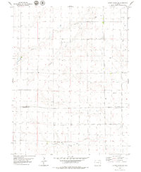
1979 Map of Alpine Ranch SW
USGS Topo · Published 1979About this map
South Fork Landsman Creek meanders through the northern plains of this High Plains quadrangle, illustrating the drainage patterns of the eastern Colorado steppe during the late 1970s. The landscape is defined by its agricultural and resource-extraction character, marked by a scattering of wells and a small Gravel Pit in the northern reaches. This 1979 edition highlights the administrative transition between the High Plains counties, following the east-west boundary of Kit Carson Co and Cheyenne Co. In the south, the North Fork Smoky Hill River carves a distinct path across the terrain, showing the vital role of these seasonal watercourses in an arid environment. The map provides a detailed view of the section-line roads and fenced boundaries that shaped the rural land use and ranching history of the region prior to modern industrial shifts.
Find a feature on this map
5 named features on this map. Tap any name to fly to it.
Don’t see what you’re looking for? This feature index may not catch every label — zoom into the map to look around manually.
Map Details
Editions of this 1979 Alpine Ranch SW Map
This is the sole edition of this map. No revisions or reprints were ever made.
Other maps of this area

1891 · Kit Carson
USGS Topo · 1:125,000

1893 · Kit Carson
USGS Topo · 1:125,000

1954 · Limon
USGS Topo · 1:250,000

1954 · Lamar
USGS Topo · 1:250,000

1957 · Limon
USGS Topo · 1:250,000

1958 · Limon
USGS Topo · 1:250,000

1958 · Lamar
USGS Topo · 1:250,000

1969 · Alpine Ranch NE
USGS Topo · 1:24,000

1969 · Alpine Ranch
USGS Topo · 1:24,000

1979 · Stratton 3 SE
USGS Topo · 1:24,000