
1969 Map of Alpine Ranch NE
USGS Topo · Published 1972About this map
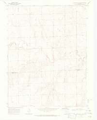
Landsman Creek winds through the western reaches of this High Plains landscape, carved into the Kit Carson County terrain during a period of steady ranching and agricultural operation. The survey, conducted via photogrammetry in 1968, documents a sparse but functional network of rural infrastructure, including a small Landing Strip and numerous Wells scattered across the township sections. These water sources indicate the vital necessity of groundwater for sustaining the area's agricultural life. Along the southern boundary, the ephemeral bed of Sand Creek cuts across the range, while localized industrial activity is evidenced by several Gravel Pits and a lone Gravel Pit located near the center of the quadrangle. The map captures the quiet, expansive nature of eastern Colorado before later development, showing the section lines and unimproved roads that defined the local movement and land ownership of the era.
Find a feature on this map
6 named features on this map. Tap any name to fly to it.
Don’t see what you’re looking for? This feature index may not catch every label — zoom into the map to look around manually.
Map Details
Editions of this 1969 Alpine Ranch NE Map
This is the sole edition of this map. No revisions or reprints were ever made.
Other maps of this area

1954 · Limon
USGS Topo · 1:250,000

1957 · Limon
USGS Topo · 1:250,000

1958 · Limon
USGS Topo · 1:250,000

1969 · Bethune
USGS Topo · 1:24,000

1969 · Burlington 3 NW
USGS Topo · 1:24,000

1969 · Stratton
USGS Topo · 1:24,000

1969 · Alpine Ranch
USGS Topo · 1:24,000
1969 · Burlington 3 SW
USGS Topo · 1:24,000
1970 · South of Bethune
USGS Topo · 1:24,000

1979 · Vona
USGS Topo · 1:24,000