
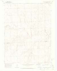
1969 Map of Burlington 3 NW
USGS Topo · Published 1972About this map
Beloit Cem serves as a quiet landmark on this high plains landscape of Kit Carson County, surveyed just before the 1970s. The terrain is defined by the drainage patterns of Landsman Creek, Beaver Creek, and Sand Creek, which cut through the open country and organize the placement of the area's few developed features. In this agricultural region, the map records the locations of numerous water wells and a Gravel Pit, illustrating the vital role of local resource extraction and groundwater management in sustaining the rural economy. The presence of fine red dashed lines indicating fence lines suggests a landscape dominated by large-scale ranching or farming divisions, where boundary markers and natural creek beds were the primary orienting points for residents and land managers during this era.
Find a feature on this map
6 named features on this map. Tap any name to fly to it.
Don’t see what you’re looking for? This feature index may not catch every label — zoom into the map to look around manually.
Map Details
Editions of this 1969 Burlington 3 NW Map
This is the sole edition of this map. No revisions or reprints were ever made.
Other maps of this area

1954 · Limon
USGS Topo · 1:250,000

1957 · Limon
USGS Topo · 1:250,000

1958 · Limon
USGS Topo · 1:250,000

1969 · Alpine Ranch NE
USGS Topo · 1:24,000

1969 · Burlington 3 SE
USGS Topo · 1:24,000

1969 · Bethune
USGS Topo · 1:24,000

1969 · Burlington
USGS Topo · 1:24,000

1969 · Stratton
USGS Topo · 1:24,000

1969 · Alpine Ranch
USGS Topo · 1:24,000
1969 · Burlington 3 SW
USGS Topo · 1:24,000