
1978 Map of Galatea NE
USGS Topo · Published 1978About this map
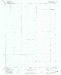
Rush Creek meanders through the arid High Plains landscape of eastern Colorado, defining the primary drainage pattern of this Cheyenne County territory. The 1970s terrain is characterized by sparse water resources, with isolated Well sites and several Tanks providing necessary hydration for cattle ranching in the open range. In the southeastern portion of the map, the named location of Jacobs serves as a small waypoint for local history and genealogy research. Economic activity in the area is represented by a Gravel Pit located south of the creek, while the presence of established fence lines across the sectioned grid reflects the ongoing agricultural division of the prairie. This survey captures a moment of quiet continuity in the rural Colorado interior, where land use remains closely tied to the available hydrology of the Wells.
Find a feature on this map
6 named features on this map. Tap any name to fly to it.
Don’t see what you’re looking for? This feature index may not catch every label — zoom into the map to look around manually.
Map Details
Editions of this 1978 Galatea NE Map
This is the sole edition of this map. No revisions or reprints were ever made.
Other maps of this area

1891 · Arroyo
USGS Topo · 1:125,000

1891 · Kit Carson
USGS Topo · 1:125,000

1893 · Arroyo
USGS Topo · 1:125,000

1893 · Kit Carson
USGS Topo · 1:125,000

1954 · Lamar
USGS Topo · 1:250,000

1958 · Lamar
USGS Topo · 1:250,000

1978 · Aroya
USGS Topo · 1:24,000
1978 · Galatea SW
USGS Topo · 1:24,000

1978 · Stacy Lakes Draw
USGS Topo · 1:24,000
1978 · Wild Horse
USGS Topo · 1:24,000