
1978 Map of Stacy Lakes Draw
USGS Topo · Published 1978About this map
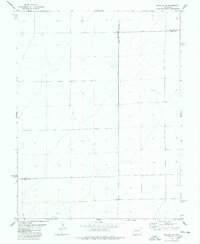
Rush Creek and its seasonal drainage, Stacy Lakes Draw, define the hydrology of this high plains borderland where Lincoln and Cheyenne counties meet. Mapping in the late 1970s reveals a landscape focused on ranching and water management, centered around the ephemeral Stacy Lakes and reliable watering points like Stacy Spring. This era shows the persistence of remote outposts such as Brown Mill Ranch and the small settlement of Trade, which anchoring the local transport network. The presence of several Gravel Pits and scattered Wells illustrates the ongoing extraction of local resources and the necessity of groundwater for sustaining the area's agricultural operations. The map provides a clear picture of the vast open-range character of eastern Colorado before more modern land-use changes.
Find a feature on this map
9 named features on this map. Tap any name to fly to it.
Don’t see what you’re looking for? This feature index may not catch every label — zoom into the map to look around manually.
Map Details
Editions of this 1978 Stacy Lakes Draw Map
This is the sole edition of this map. No revisions or reprints were ever made.
Other maps of this area

1891 · Arroyo
USGS Topo · 1:125,000

1893 · Arroyo
USGS Topo · 1:125,000

1954 · Lamar
USGS Topo · 1:250,000

1958 · Lamar
USGS Topo · 1:250,000

1978 · Galatea NE
USGS Topo · 1:24,000

1978 · Aroya
USGS Topo · 1:24,000

1978 · Barrel Springs Draw
USGS Topo · 1:24,000
1978 · Galatea SW
USGS Topo · 1:24,000

1978 · Rock Basin
USGS Topo · 1:24,000
1978 · Wild Horse
USGS Topo · 1:24,000