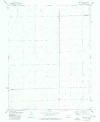
1978 Map of Galatea SW
USGS Topo · Published 1978About this map
The high plains of eastern Colorado converge where Lincoln Co Cheyenne Co, Cheyenne Co Kiowa Co, and Lincoln Co Kiowa Co meet. This 1970s landscape is defined by its subtle topography and the critical presence of water, as evidenced by the solitary Well and various windmills scattered across the sections. The map serves as a detailed record of land use and surveying in a sparsely populated region, showing the precise placement of light-duty and unimproved roads that navigate the arid terrain.
Find a feature on this map
5 named features on this map. Tap any name to fly to it.
Don’t see what you’re looking for? This feature index may not catch every label — zoom into the map to look around manually.
Map Details
Editions of this 1978 Galatea SW Map
This is the sole edition of this map. No revisions or reprints were ever made.
Other maps of this area

1891 · Arroyo
USGS Topo · 1:125,000

1891 · Las Animas
USGS Topo · 1:125,000

1893 · Arroyo
USGS Topo · 1:125,000

1893 · Las Animas
USGS Topo · 1:125,000

1954 · Lamar
USGS Topo · 1:250,000

1958 · Lamar
USGS Topo · 1:250,000

1974 · Haswell
USGS Topo · 1:24,000

1974 · Arlington NE
USGS Topo · 1:24,000

1978 · Galatea NE
USGS Topo · 1:24,000
1978 · Haswell NE
USGS Topo · 1:24,000