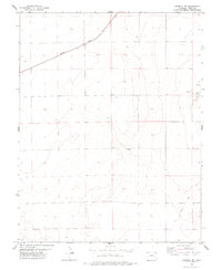
1978 Map of Haswell NE
USGS Topo · Published 1978About this map
The Missouri Pacific railroad cuts diagonally across the high plains of Kiowa County in the late 1970s, serving as the primary infrastructure for this arid landscape. Small rail-side points like Milan and the southern settlement of Hub represent the sparse human footprint in an area dominated by dry drainage basins and intermittent water sources. To the east, an Old Railroad Grade marks a former path of travel, now superseded or removed, providing a clear reference for those tracing historical transportation corridors. The terrain is characterized by subtle depressions and salt-encrusted basins, most notably Salt Lake, while several wells and springs scattered across the township lines indicate the critical importance of groundwater for local ranching operations. Modern industrial activity is minimal, represented only by a solitary Gravel Pit located near the center of the survey.
Find a feature on this map
11 named features on this map. Tap any name to fly to it.
Don’t see what you’re looking for? This feature index may not catch every label — zoom into the map to look around manually.
Map Details
Editions of this 1978 Haswell NE Map
This is the sole edition of this map. No revisions or reprints were ever made.
Other maps of this area

1891 · Arroyo
USGS Topo · 1:125,000

1891 · Kit Carson
USGS Topo · 1:125,000

1891 · Las Animas
USGS Topo · 1:125,000

1892 · Lamar
USGS Topo · 1:125,000

1893 · Arroyo
USGS Topo · 1:125,000

1893 · Kit Carson
USGS Topo · 1:125,000

1893 · Las Animas
USGS Topo · 1:125,000

1954 · Lamar
USGS Topo · 1:250,000

1958 · Lamar
USGS Topo · 1:250,000

1968 · Rose Ranch
USGS Topo · 1:24,000