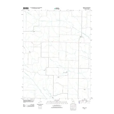
2012 Map of Arbela
USGS Topo · Published 2012About this map
Arbela serves as the primary settlement in this corner of Scotland County, situated near the headwaters of several key Missouri waterways. The drainage patterns here are complex, featuring the South Wyaconda River and its Old Channel, alongside Allen Creek and Bear Creek. In the southern reaches, the North Fabius River winds through the landscape, supported by localized infrastructure like the Bear Creek Watershed Dam A-2. For family historians, the area is punctuated by several longstanding burial grounds including Conyers Cemetery, Buskirk Cemetery, Union Cemetery, and Shacklett Cemetery. Transportation and utility are reflected in a network of named local routes such as Chancellor Rd and Hazel Hill Rd, while aviation interests are marked by Howard Airport and Wileys Air Strip.
Find a feature on this map
28 named features on this map. Tap any name to fly to it.
Don’t see what you’re looking for? This feature index may not catch every label — zoom into the map to look around manually.
Map Details
Editions of this 2012 Arbela Map
This is the sole edition of this map. No revisions or reprints were ever made.
Other maps of this area

1903 · Kahoka
USGS Topo · 1:125,000

1903 · Edina
USGS Topo · 1:125,000

1950 · Colony
USGS Topo · 1:24,000

1951 · Colony
USGS Topo · 1:24,000

1951 · Wyaconda
USGS Topo · 1:24,000

1954 · Centerville
USGS Topo · 1:250,000

1957 · Centerville
USGS Topo · 1:250,000

1958 · Centerville
USGS Topo · 1:250,000

1958 · Burlington
USGS Topo · 1:250,000

1961 · Burlington
USGS Topo · 1:250,000