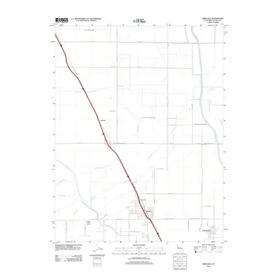
2012 Map of Arbuckle
USGS Topo · Published 2012About this map
Agricultural life in Colusa County centers around the town of Arbuckle and the nearby settlement of College City, where the flat valley landscape is defined by an intricate network of irrigation and drainage. The Glenn-Colusa Canal and Tehama Colusa Canal dominate the western and central reaches, feeding the local economy, while the Colusa Trough and Sycamore Slough manage the water flow to the east. The map records a grid of rural roads such as Lone Star Rd and Grimes Arbuckle Rd that connect outlying ranching operations. Along the path of Old Hwy 99W, the small community of Genevra sits near where Cortina Creek crosses the corridor. Local aviation is represented by the McCabe Ranch Airport situated near Elk Creek, providing a specialized look at the infrastructure supporting large-scale California ranching operations in the early 21st century.
Find a feature on this map
44 named features on this map. Tap any name to fly to it.
Don’t see what you’re looking for? This feature index may not catch every label — zoom into the map to look around manually.
Map Details
Editions of this 2012 Arbuckle Map
This is the sole edition of this map. No revisions or reprints were ever made.
Other maps of this area

1888 · Marysville
USGS Topo · 1:125,000

1891 · Marysville
USGS Topo · 1:125,000

1894 · Marysville
USGS Topo · 1:125,000

1895 · Marysville
USGS Topo · 1:125,000

1905 · Harrington
USGS Topo · 1:24,000

1907 · Dunnigan
USGS Topo · 1:62,500

1907 · Colusa
USGS Topo · 1:62,500

1911 · Grimes
USGS Topo · 1:31,680

1912 · Meridian
USGS Topo · 1:31,680

1916 · Harrington
USGS Topo · 1:31,680