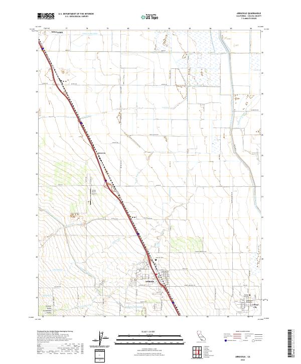
2022 Map of Arbuckle
USGS Topo · Published 2022About this map
Agricultural patterns in the Sacramento Valley are meticulously documented on this sheet, defined by the sophisticated water management of the Glenn-Colusa Canal and Tehama Colusa Canal. Centered on Arbuckle, the landscape is a grid of orchards and fields interspersed with natural drainages like Cortina Cr and N Br Sand Cr. The infrastructure supports a series of specialized nodes, from the aviation facilities at Strain Ranch Airport to the tight-knit grid of College City. Genealogists will find the locations of the Arbuckle Cem and College City Cem particularly useful for locating ancestral homesteads in the Central Valley. The road network, including Hillgate Rd and Meyers Rd, reflects a landscape deeply committed to large-scale cultivation and the transit of goods toward northern hubs like Williams.
Find a feature on this map
73 named features on this map. Tap any name to fly to it.
Don’t see what you’re looking for? This feature index may not catch every label — zoom into the map to look around manually.
Map Details
Editions of this 2022 Arbuckle Map
This is the sole edition of this map. No revisions or reprints were ever made.
Other maps of this area

1888 · Marysville
USGS Topo · 1:125,000

1891 · Marysville
USGS Topo · 1:125,000

1894 · Marysville
USGS Topo · 1:125,000

1895 · Marysville
USGS Topo · 1:125,000

1905 · Harrington
USGS Topo · 1:24,000

1907 · Dunnigan
USGS Topo · 1:62,500

1907 · Colusa
USGS Topo · 1:62,500

1911 · Grimes
USGS Topo · 1:31,680

1912 · Meridian
USGS Topo · 1:31,680

1916 · Harrington
USGS Topo · 1:31,680