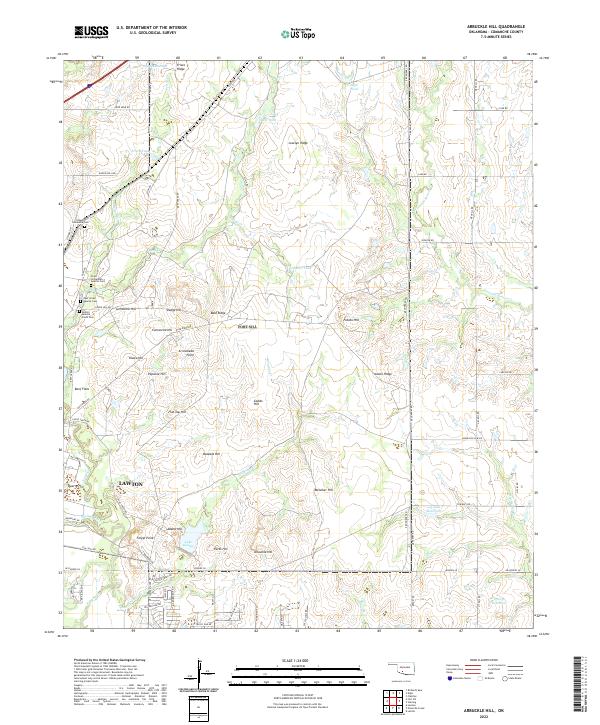
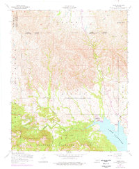
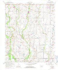
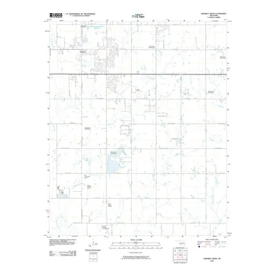
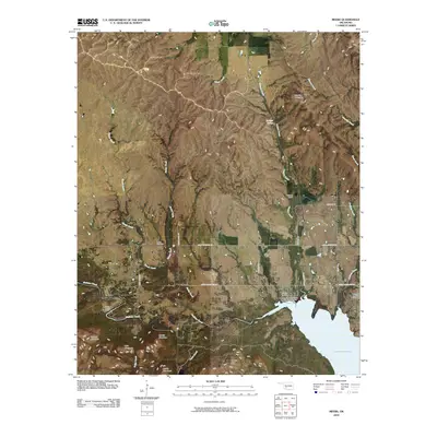
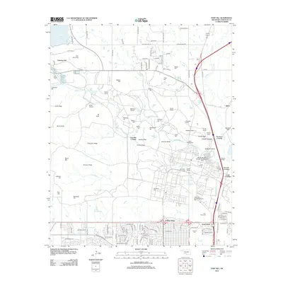
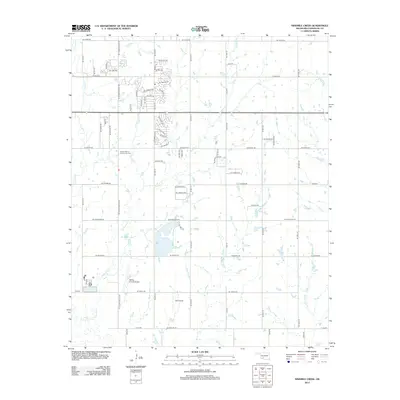
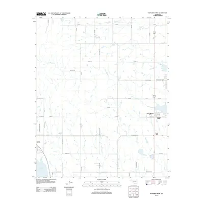
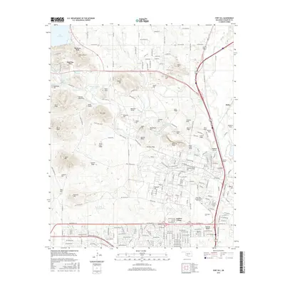
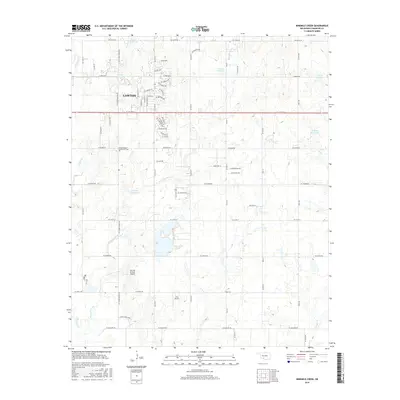
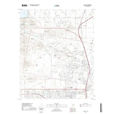
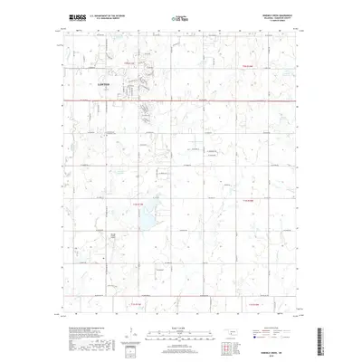
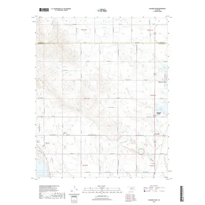
2022 Map of Arbuckle Hill
USGS Topo · Published 2022About this map
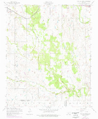
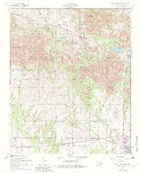
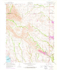
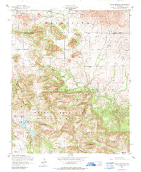
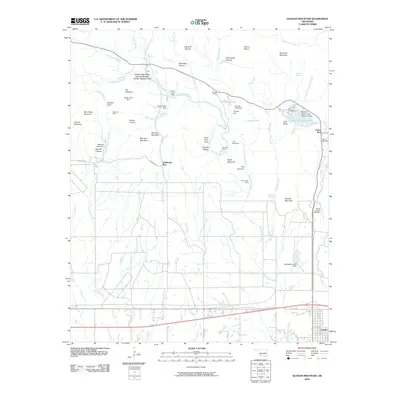
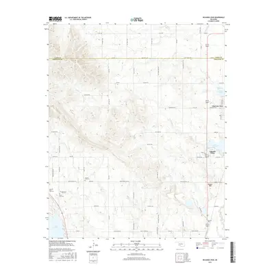
Indigenous heritage and varied upland terrain define this portion of Comanche County just north of the city of Lawton. A cluster of significant burial sites, including the Otipoby Comanche Cem, Chief Chihuahua Apache Cem, and Bailltso Apache South Cem, reflects the deep history of the Apache and Comanche peoples in the area. The landscape is characterized by numerous named prominences such as Geronimo Hill, Comanche Hill, and the eponymous Arbuckle Hill. Water features like Wratton Cr and Ninemile Beaver Cr drain the higher ground of Beef Flats and Frisco Ridge. The map details the transition from the city outskirts near Feigel Point into the expansive ridges and points of the surrounding countryside, including distinctive landmarks like Arrowhead Point and Papoose Hill.
Find a feature on this map
88 named features on this map. Tap any name to fly to it.
Don’t see what you’re looking for? This feature index may not catch every label — zoom into the map to look around manually.
Map Details
Editions of this 2022 Arbuckle Hill Map
This is the sole edition of this map. No revisions or reprints were ever made.
Historical Maps of Lawton Through Time
95 maps found

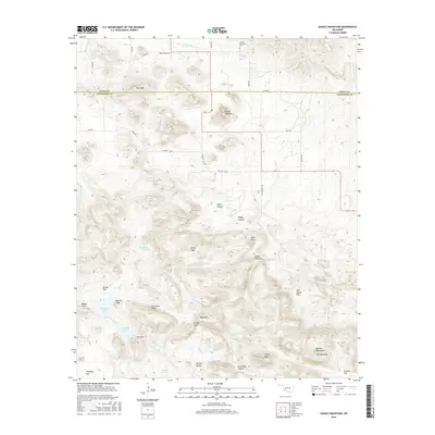
1937 Quanah Mountain
Comanche County, OK

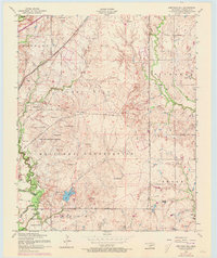
1949 Arbuckle Hill
Comanche County, OK

1949 Fort Sill
Comanche County, OK

1949 Mount Scott
Comanche County, OK

1949 Nellie
Comanche County, OK

1949 Quanah Mountain
Comanche County, OK

1950 Saddle Mountain
Comanche County, OK
1956 Arbuckle Hill
Comanche County, OK
1956 Fort Sill
Comanche County, OK
1956 Letitia
Comanche County, OK
1956 Meers
Comanche County, OK
1956 Mount Scott
Comanche County, OK

1956 Nellie
Comanche County, OK
1956 Ninemile Creek
Comanche County, OK
1956 Odetta
Comanche County, OK
1956 Post Oak Creek
Comanche County, OK
1956 Quanah Mountain
Comanche County, OK
1956 Richards Spur
Comanche County, OK

1956 Saddle Mountain
Comanche County, OK
1956 Saddle Mountain
Comanche County, OK
1956 Taupa
Comanche County, OK

1991 Arbuckle Hill
Comanche County, OK

1991 Fort Sill
Comanche County, OK

1991 Letitia
Comanche County, OK

1991 Meers
Comanche County, OK

1991 Mount Scott
Comanche County, OK

1991 Ninemile Creek
Comanche County, OK

1991 Odetta
Comanche County, OK

1991 Post Oak Creek
Comanche County, OK

1991 Quanah Mountain
Comanche County, OK
1991 Richards Spur
Comanche County, OK
1991 Saddle Mountain
Comanche County, OK

1991 Taupa
Comanche County, OK

1997 Mount Scott
Comanche County, OK

1997 Quanah Mountain
Comanche County, OK
2009 Arbuckle Hill
Comanche County, OK
2009 Ninemile Creek
Comanche County, OK
2009 Taupa
Comanche County, OK
2010 Fort Sill
Comanche County, OK
2010 Letitia
Comanche County, OK
2010 Meers
Comanche County, OK
2010 Mount Scott
Comanche County, OK
2010 Odetta
Comanche County, OK
2010 Post Oak Creek
Comanche County, OK
2010 Quanah Mountain
Comanche County, OK
2010 Richards Spur
Comanche County, OK
2010 Saddle Mountain
Comanche County, OK
2012 Arbuckle Hill
Comanche County, OK
2012 Fort Sill
Comanche County, OK
2012 Letitia
Comanche County, OK
2012 Meers
Comanche County, OK
2012 Mount Scott
Comanche County, OK
2012 Ninemile Creek
Comanche County, OK
2012 Odetta
Comanche County, OK
2012 Post Oak Creek
Comanche County, OK
2012 Quanah Mountain
Comanche County, OK
2012 Richards Spur
Comanche County, OK
2012 Saddle Mountain
Comanche County, OK
2012 Taupa
Comanche County, OK
2016 Arbuckle Hill
Comanche County, OK
2016 Fort Sill
Comanche County, OK
2016 Letitia
Comanche County, OK
2016 Meers
Comanche County, OK
2016 Mount Scott
Comanche County, OK
2016 Ninemile Creek
Comanche County, OK
2016 Odetta
Comanche County, OK
2016 Post Oak Creek
Comanche County, OK
2016 Quanah Mountain
Comanche County, OK
2016 Richards Spur
Comanche County, OK
2016 Saddle Mountain
Comanche County, OK
2016 Taupa
Comanche County, OK
2018 Arbuckle Hill
Comanche County, OK
2018 Fort Sill
Comanche County, OK
2018 Letitia
Comanche County, OK
2018 Meers
Comanche County, OK
2018 Mount Scott
Comanche County, OK
2018 Ninemile Creek
Comanche County, OK
2018 Odetta
Comanche County, OK
2018 Post Oak Creek
Comanche County, OK
2018 Quanah Mountain
Comanche County, OK
2018 Richards Spur
Comanche County, OK
2018 Saddle Mountain
Comanche County, OK
2018 Taupa
Comanche County, OK
2022 Arbuckle Hill
Comanche County, OK
2022 Fort Sill
Comanche County, OK
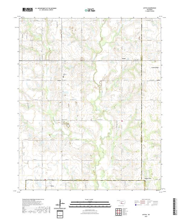
2022 Letitia
Comanche County, OK
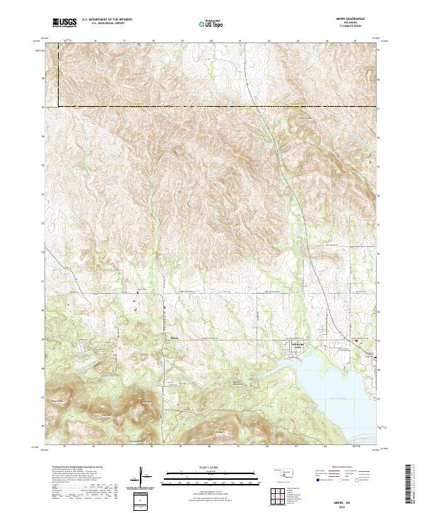
2022 Meers
Comanche County, OK
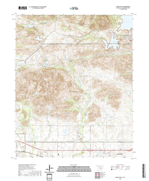
2022 Mount Scott
Comanche County, OK
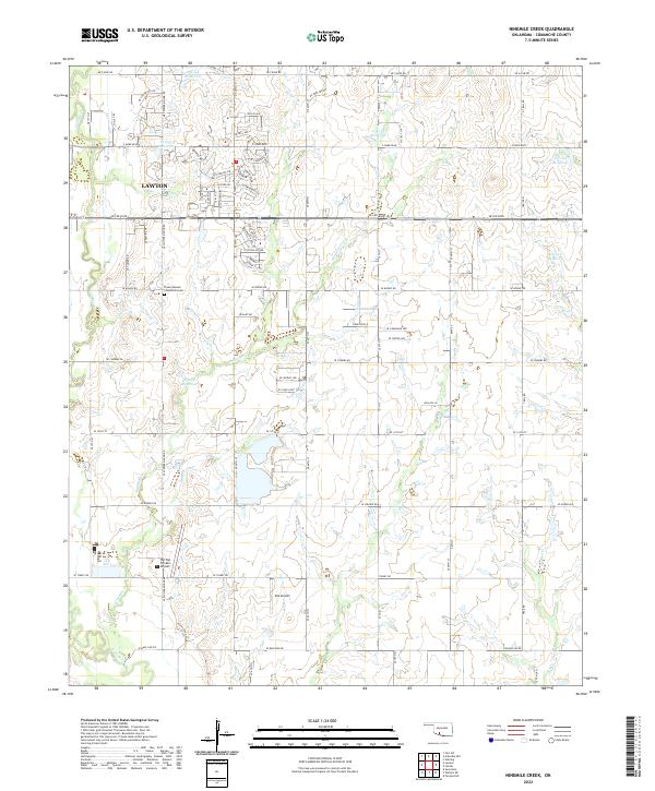
2022 Ninemile Creek
Comanche County, OK
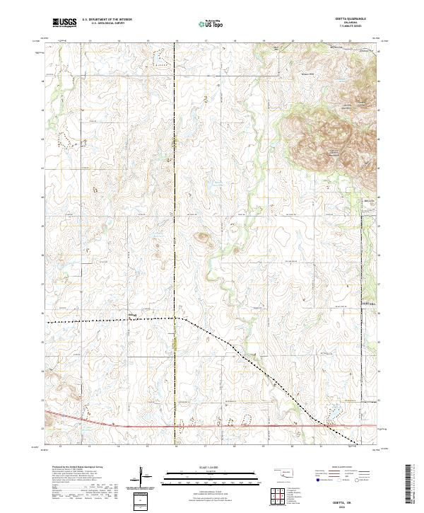
2022 Odetta
Comanche County, OK
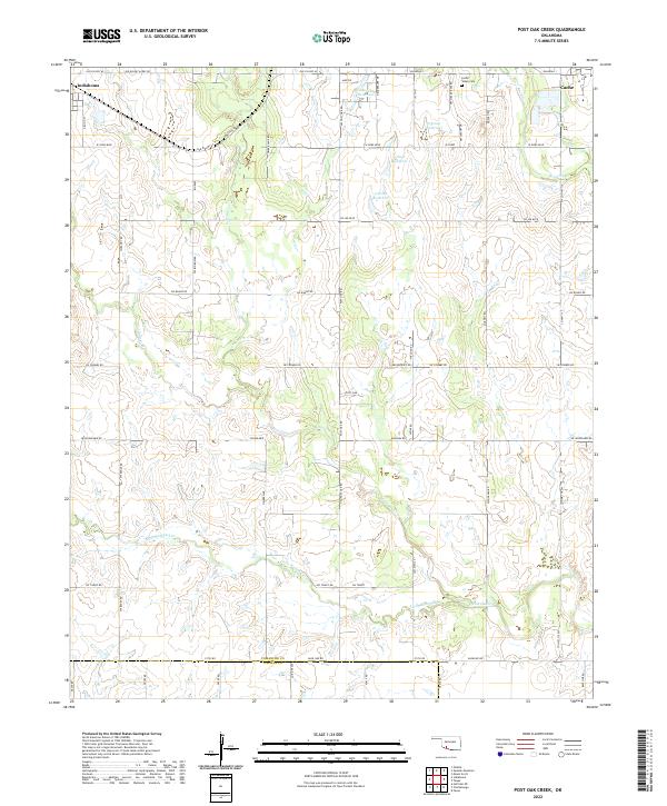
2022 Post Oak Creek
Comanche County, OK
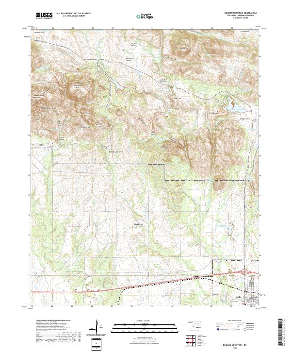
2022 Quanah Mountain
Comanche County, OK
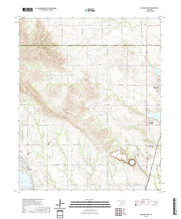
2022 Richards Spur
Comanche County, OK
2022 Saddle Mountain
Comanche County, OK
2022 Taupa
Comanche County, OK
Featured Locations
- South East Corner Landing Strip, OK
- Lawton, OK
- Dempsey Bridge, Lawton
- Pig Farm Crossing, Lawton
- Beef Flats, Lawton