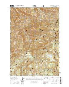
2014 Map of Arbuckle Mountain
USGS Topo · Published 2014About this map
Umatilla National Forest encompasses the high ridges and deep canyons of this 2014 survey in Morrow County. The landscape is defined by a series of named openings and high-elevation meadows, including Herren Meadow, Linger Longer Prairie, and Kelly Prairie. These open spaces are separated by prominent summits like Arbuckle Mountain, Black Mtn, and Kelly Mtn. This area has long supported seasonal grazing and timber activities, indicated by the network of Forest Service roads and landmarks such as Butcher Bill Meadow and Cutsforth Pond.
Find a feature on this map
66 named features on this map. Tap any name to fly to it.
Don’t see what you’re looking for? This feature index may not catch every label — zoom into the map to look around manually.
Map Details
Editions of this 2014 Arbuckle Mountain Map
This is the sole edition of this map. No revisions or reprints were ever made.
Other maps of this area

1953 · Pendleton
USGS Topo · 1:250,000

1956 · Pendleton
USGS Topo · 1:250,000

1967 · Freezeout Ridge
USGS Topo · 1:24,000

1968 · Hoodlum Canyon
USGS Topo · 1:24,000

1968 · Skinners Fork
USGS Topo · 1:24,000

1969 · Summerfield Ridge
USGS Topo · 1:24,000

1969 · Lake Penland
USGS Topo · 1:24,000

1969 · Thompson Flat
USGS Topo · 1:24,000

1969 · Arbuckle Mtn
USGS Topo · 1:24,000
1969 · Matlock Prairie
USGS Topo · 1:24,000