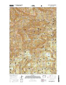
2017 Map of Arbuckle Mountain
USGS Topo · Published 2017About this map
Arbuckle Mountain and the surrounding high country of the Umatilla National Forest dominate this landscape in Morrow County. The area is characterized by a network of high-elevation meadows and ridges, often named for early settlers and ranchers, such as Herren Meadow, Butcher Bill Meadow, and Martin Prairie. The geography here is defined by a series of prominent peaks including Black Mtn, Kelly Mtn, and Bald Mtn, which serve as the headwaters for numerous drainages like Willow Cr and Potamus Cr. The 2017 survey reflects the remote, managed nature of the land, showing an intricate system of forest development roads and specialized trails like the Hells Half Acre Trail and the Old Western Route. Local heritage is preserved in place names like Coalmine Hill and Sawmill Canyon, hinting at the historical extraction and timber industries that once utilized these mountain resources.
Find a feature on this map
83 named features on this map. Tap any name to fly to it.
Don’t see what you’re looking for? This feature index may not catch every label — zoom into the map to look around manually.
Map Details
Editions of this 2017 Arbuckle Mountain Map
This is the sole edition of this map. No revisions or reprints were ever made.
Other maps of this area

1953 · Pendleton
USGS Topo · 1:250,000

1956 · Pendleton
USGS Topo · 1:250,000

1967 · Freezeout Ridge
USGS Topo · 1:24,000

1968 · Hoodlum Canyon
USGS Topo · 1:24,000

1968 · Skinners Fork
USGS Topo · 1:24,000

1969 · Summerfield Ridge
USGS Topo · 1:24,000

1969 · Lake Penland
USGS Topo · 1:24,000

1969 · Thompson Flat
USGS Topo · 1:24,000

1969 · Arbuckle Mtn
USGS Topo · 1:24,000
1969 · Matlock Prairie
USGS Topo · 1:24,000