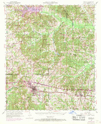
1950 Map of Arcadia
USGS Topo · Published 1969About this map
The town of Arcadia serves as a primary hub for this mid-century portrait of North Louisiana, where the Illinois Central railroad cuts through the heart of the community. The landscape is a dense network of parish-line communities like Simsboro and Hurricane, defined by an extraordinary concentration of rural institutions. Schools such as Richland Sch, Sunshine Sch, and Hebron Sch are found alongside local spiritual centers like Macedonia Ch and Mt Moriah Ch, reflecting the dispersed settlement pattern of the era.
Find a feature on this map
62 named features on this map. Tap any name to fly to it.
Don’t see what you’re looking for? This feature index may not catch every label — zoom into the map to look around manually.
Map Details
Editions of this 1950 Arcadia Map
4 editions found
Other maps of this area

1947 · Bienville
USGS Topo · 1:62,500

1948 · Jamestown
USGS Topo · 1:62,500

1949 · Jamestown
USGS Topo · 1:62,500

1949 · Bienville
USGS Topo · 1:62,500

1949 · Gibsland
USGS Topo · 1:62,500

1950 · Gibsland
USGS Topo · 1:62,500

1950 · Ruston
USGS Topo · 1:62,500

1950 · Arcadia
USGS Topo · 1:62,500

1951 · Arcadia
USGS Topo · 1:62,500

1951 · Ruston
USGS Topo · 1:62,500