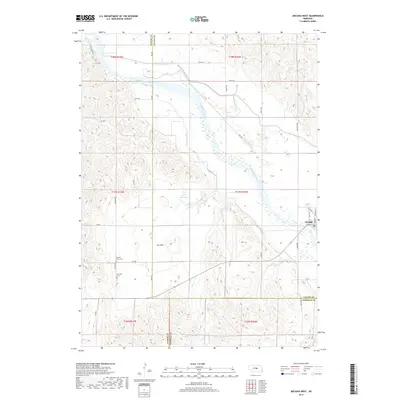
2017 Map of Arcadia West
USGS Topo · Published 2017About this map
The Middle Loup River carves a broad valley through this Nebraska landscape, defining the agricultural and water-management patterns of the region. The village of Arcadia sits at the eastern edge, showing its grid of streets including Bridge St and Railroad St. The area's reliance on irrigation is evidenced by the complex network of Canal Number 3 and Canal Number 4 that divert water across the plains.
Find a feature on this map
42 named features on this map. Tap any name to fly to it.
Don’t see what you’re looking for? This feature index may not catch every label — zoom into the map to look around manually.
Map Details
Editions of this 2017 Arcadia West Map
This is the sole edition of this map. No revisions or reprints were ever made.
Other maps of this area

1951 · Ansley NE
USGS Topo · 1:24,000

1951 · Arcadia SE
USGS Topo · 1:24,000

1951 · Arcadia West
USGS Topo · 1:24,000

1951 · Arcadia East
USGS Topo · 1:24,000

1951 · Ansley SE
USGS Topo · 1:24,000

1951 · Arcadia SW
USGS Topo · 1:24,000

1952 · Sargent SE
USGS Topo · 1:24,000

1952 · Comstock
USGS Topo · 1:24,000

1952 · Comstock SE
USGS Topo · 1:24,000

1955 · Broken Bow
USGS Topo · 1:250,000