
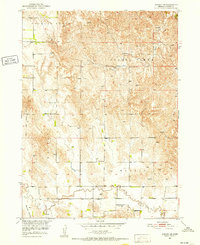
1951 Map of Ansley NE
USGS Topo · Published 1952About this map
The rolling tablelands of central Nebraska's Custer County are defined here by a network of rural schoolhouses and small family landmarks during the early 1950s. The landscape is divided into named precints such as Douglas Grove and Spring Creek, with much of the human activity concentrated along the meandering courses of Spring Creek and Clear Creek. For genealogists, the map reveals the precise locations of essential community hubs like Mt Custer Sch, Myrtle Sch, and Clear Creek Sch, alongside the Swanson Cem in the northwest. Numerous windmills are scattered across the terrain, indicating the vital importance of groundwater management for the agricultural life in Westerville and Myrtle townships. The topography transitions into the prominent Moody Valley at the southern edge, illustrating the area's drainage towards the larger Missouri River Basin.
Find a feature on this map
13 named features on this map. Tap any name to fly to it.
Don’t see what you’re looking for? This feature index may not catch every label — zoom into the map to look around manually.
Map Details
Editions of this 1951 Ansley NE Map
3 editions found

Other maps of this area

1951 · Westerville
USGS Topo · 1:24,000

1951 · Ansley
USGS Topo · 1:24,000

1951 · Arcadia West
USGS Topo · 1:24,000

1951 · Ansley SE
USGS Topo · 1:24,000

1951 · Arcadia SW
USGS Topo · 1:24,000

1952 · Sargent SE
USGS Topo · 1:24,000

1952 · Comstock
USGS Topo · 1:24,000

1952 · Sargent SW
USGS Topo · 1:24,000

1955 · Broken Bow
USGS Topo · 1:250,000

1956 · Broken Bow
USGS Topo · 1:250,000