
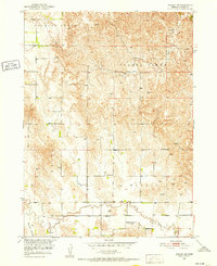
1951 Map of Ansley NE
USGS Topo · Published 1957About this map
The rural agricultural landscape of central Nebraska is meticulously detailed here, reflecting a mid-century pattern of small township districts and localized education. The territory is divided into the districts of Douglas Grove, Westerville, and Myrtle, each serving as a focal point for the surrounding farming community. This 1951 field check records a series of vital rural institutions, most notably the network of one-room schoolhouses like Mt Custer Sch, Spring Creek Sch, and Myrtle Sch that once anchored these townships. The terrain transitions from the higher elevations of Dry Valley in the northwest to the more intricate drainage systems of Spring Creek and Clear Creek. Dozens of Windmill locations are marked across the hills, tracing the essential water infrastructure required for livestock and agriculture in this Missouri River Basin region during the early 1950s.
Find a feature on this map
12 named features on this map. Tap any name to fly to it.
Don’t see what you’re looking for? This feature index may not catch every label — zoom into the map to look around manually.
Map Details
Editions of this 1951 Ansley NE Map
3 editions found
Other maps of this area

1951 · Westerville
USGS Topo · 1:24,000

1951 · Ansley
USGS Topo · 1:24,000

1951 · Ansley NE
USGS Topo · 1:24,000

1951 · Arcadia West
USGS Topo · 1:24,000

1951 · Ansley SE
USGS Topo · 1:24,000

1951 · Arcadia SW
USGS Topo · 1:24,000

1952 · Sargent SE
USGS Topo · 1:24,000

1952 · Comstock
USGS Topo · 1:24,000

1952 · Sargent SW
USGS Topo · 1:24,000

1955 · Broken Bow
USGS Topo · 1:250,000