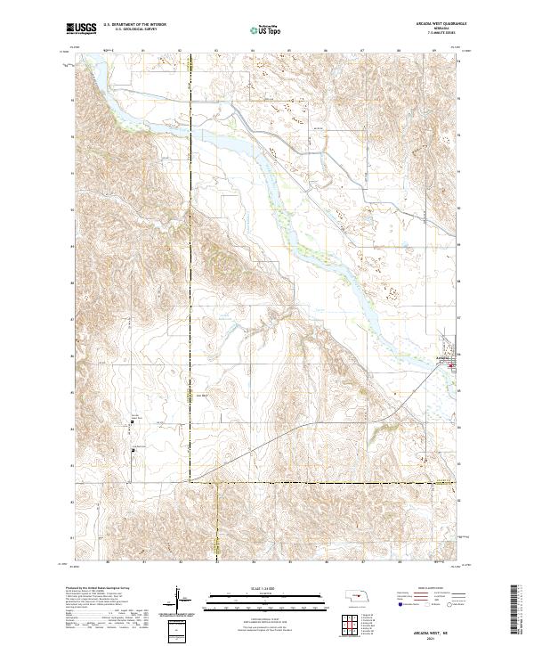
2021 Map of Arcadia West
USGS Topo · Published 2021About this map
The Middle Loup River valley dominates this landscape on the border of Valley and Custer counties, where irrigation systems like Canal Number 3 and Canal Number 4 trace the transition from river bottom to the surrounding hills. Near the village of Arcadia, a network of rural roads including Bridge St and Reynolds St connects the riverbank to the upland farming communities. To the southwest, the settlement of Lee Park serves as a local landmark near the Lee Park Cem and Sacred Heart Cem. This area demonstrates a carefully managed water landscape, with Lewin Reservoir and various creeks like Cottonwood Cr and Spring Cr supporting the agricultural economy of central Nebraska.
Find a feature on this map
43 named features on this map. Tap any name to fly to it.
Don’t see what you’re looking for? This feature index may not catch every label — zoom into the map to look around manually.
Map Details
Editions of this 2021 Arcadia West Map
This is the sole edition of this map. No revisions or reprints were ever made.
Other maps of this area

1951 · Ansley NE
USGS Topo · 1:24,000

1951 · Arcadia SE
USGS Topo · 1:24,000

1951 · Arcadia West
USGS Topo · 1:24,000

1951 · Arcadia East
USGS Topo · 1:24,000

1951 · Ansley SE
USGS Topo · 1:24,000

1951 · Arcadia SW
USGS Topo · 1:24,000

1952 · Sargent SE
USGS Topo · 1:24,000

1952 · Comstock
USGS Topo · 1:24,000

1952 · Comstock SE
USGS Topo · 1:24,000

1955 · Broken Bow
USGS Topo · 1:250,000