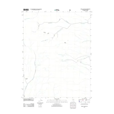
2012 Map of Arch Canyon
USGS Topo · Published 2012About this map
Lexington Arch and the surrounding wilderness of White Pine County define this high-altitude landscape. The map centers on the dramatic erosional features of Arch Canyon and Black Canyon, where intricate drainage systems such as Lexington Creek and the South Fork Lexington Creek have carved deep into the terrain. Remote springs provide critical water points in this arid environment, including Cedar Cabin Spring, North Spring, and South Spring. The infrastructure is sparse, limited primarily to primitive routes like Lexington Creek Rd and NFD 468 Rd, which navigate the complex canyons and washes. This 2012 survey illustrates a landscape dominated by natural geology and seasonal water flow, as seen in the extensive reaches of Big Spring Wash and Chokecherry Creek.
Find a feature on this map
16 named features on this map. Tap any name to fly to it.
Don’t see what you’re looking for? This feature index may not catch every label — zoom into the map to look around manually.
Map Details
Editions of this 2012 Arch Canyon Map
This is the sole edition of this map. No revisions or reprints were ever made.
Other maps of this area

1948 · Wheeler Peak
USGS Topo · 1:62,500

1949 · Garrison
USGS Topo · 1:62,500

1950 · Wheeler Peak
USGS Topo · 1:62,500

1951 · Garrison
USGS Topo · 1:62,500

1956 · Lund
USGS Topo · 1:250,000

1960 · Lund
USGS Topo · 1:250,000
1972 · Tweedy Wash
USGS Topo · 1:24,000

1972 · Big Springs
USGS Topo · 1:24,000

1973 · Red Ledges
USGS Topo · 1:24,000
1979 · Garrison
USGS Topo · 1:100,000