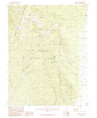
1987 Map of Arch Canyon
USGS Topo · Published 1987About this map
Great Basin National Park and Humboldt National Forest converge in this high-elevation terrain during the late 1980s. The landscape is defined by its dramatic limestone and quartzite features, most notably the massive Lexington Arch situated within Lexington Canyon. This natural formation is a rare example of a high-elevation arch, likely carved from ancient limestone.
Find a feature on this map
22 named features on this map. Tap any name to fly to it.
Don’t see what you’re looking for? This feature index may not catch every label — zoom into the map to look around manually.
Map Details
Editions of this 1987 Arch Canyon Map
This is the sole edition of this map. No revisions or reprints were ever made.
Other maps of this area

1948 · Wheeler Peak
USGS Topo · 1:62,500

1949 · Garrison
USGS Topo · 1:62,500

1950 · Wheeler Peak
USGS Topo · 1:62,500

1951 · Garrison
USGS Topo · 1:62,500

1956 · Lund
USGS Topo · 1:250,000

1960 · Lund
USGS Topo · 1:250,000
1972 · Tweedy Wash
USGS Topo · 1:24,000

1972 · Big Springs
USGS Topo · 1:24,000

1973 · Red Ledges
USGS Topo · 1:24,000
1979 · Garrison
USGS Topo · 1:100,000