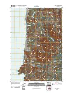
2011 Map of Arch Cape
USGS Topo · Published 2011About this map
The Pacific Ocean coastline dominates this 2011 survey of the Clatsop County shore, where the residential grids of Arch Cape and Tolovana Park meet the timbered slopes of the Oregon Coast Range. This survey details a transition from the beach-oriented settlements near the Arch Cape Post Office to the protected wilderness of Oswald West State Park in the south. The rugged topography is defined by prominent headlands like Cape Falcon and Silver Point, while inland, the landscape rises sharply toward Angora Peak and Onion Peak. Significant creek systems, including Arch Cape Creek and North Fork Ecola Creek, carve through the dense drainage patterns of the interior. Historic shoreline landmarks such as Smuggler Cove and the Devils Cauldron illustrate the treacherous nature of this coastal stretch, while the presence of the Oswald West State Park Trail highlights the area's established recreational infrastructure.
Find a feature on this map
55 named features on this map. Tap any name to fly to it.
Don’t see what you’re looking for? This feature index may not catch every label — zoom into the map to look around manually.
Map Details
Editions of this 2011 Arch Cape Map
This is the sole edition of this map. No revisions or reprints were ever made.
Other maps of this area

1937 · Nehalem
USGS Topo · 1:62,500

1940 · Cape Falcon
USGS Topo · 1:62,500

1943 · Nehalem
USGS Topo · 1:62,500

1948 · Vancouver
USGS Topo · 1:250,000

1949 · Tillamook Head
USGS Topo · 1:24,000

1950 · Vancouver
USGS Topo · 1:250,000

1950 · Vancouver
USGS Topo · 1:250,000

1955 · Nehalem
USGS Topo · 1:62,500
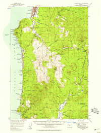
1955 · Cannon Beach
USGS Topo · 1:62,500

1958 · Vancouver
USGS Topo · 1:250,000