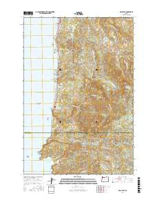
2017 Map of Arch Cape
USGS Topo · Published 2017About this map
Cannon Beach and Tolovana Park anchor the northern coastline of this survey, where the Pacific shoreline meets the dense timberlands of the Coast Range. The map details a complex geological interface of offshore landmarks like Castle Rock and Gull Rock against prominent headlands such as Hug Point, Adair Point, and Cape Falcon. Interior access is defined by the Arch Cape Tunnel 2247 and a network of logging and access roads including Arch Cape Mill Rd and the Tolovana Mainline Rd, which wind through the elevations of Onion Peak and Angora Peak. The transition between Clatsop and Tillamook counties is marked just south of Round Mtn, overlooking the secluded Smuggler Cove and the dramatic sea cliffs of Devils Cauldron. Numerous coastal creeks, such as Arch Cape Cr and Short Sand Cr, drain the high ridges into the Pacific Ocean, illustrating the drainage patterns that shaped these seaside settlements.
Find a feature on this map
62 named features on this map. Tap any name to fly to it.
Don’t see what you’re looking for? This feature index may not catch every label — zoom into the map to look around manually.
Map Details
Editions of this 2017 Arch Cape Map
This is the sole edition of this map. No revisions or reprints were ever made.
Other maps of this area

1937 · Nehalem
USGS Topo · 1:62,500

1940 · Cape Falcon
USGS Topo · 1:62,500

1943 · Nehalem
USGS Topo · 1:62,500

1948 · Vancouver
USGS Topo · 1:250,000

1949 · Tillamook Head
USGS Topo · 1:24,000

1950 · Vancouver
USGS Topo · 1:250,000

1950 · Vancouver
USGS Topo · 1:250,000

1955 · Nehalem
USGS Topo · 1:62,500
1955 · Cannon Beach
USGS Topo · 1:62,500

1958 · Vancouver
USGS Topo · 1:250,000