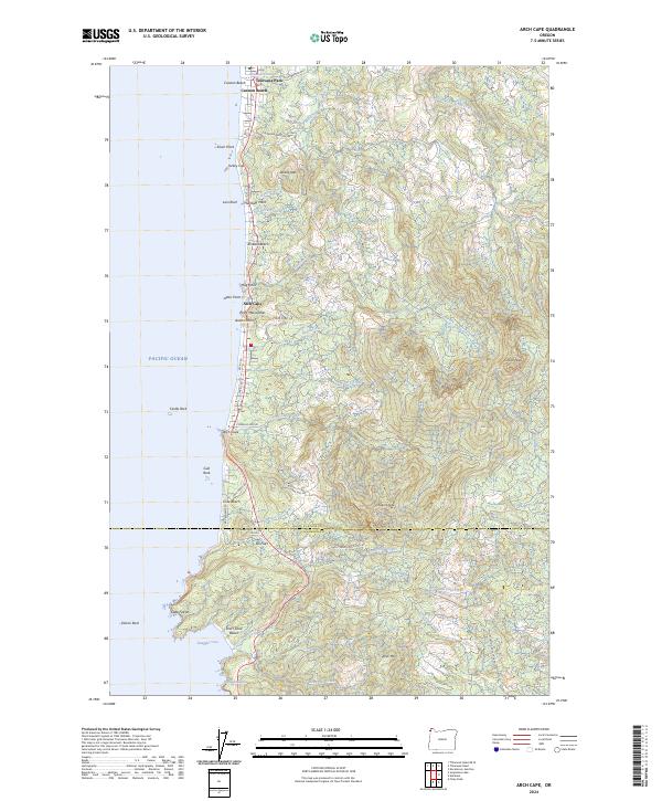
2024 Map of Arch Cape
USGS Topo · Published 2024About this map
Arch Cape and the surrounding coastline of the Pacific Ocean define this survey, where the peaks of the Northern Oregon Coast Range meet the sea. The landscape transitions from the residential clusters at Cannon Beach and Tolovana Park in the north to the protected expanses of the Oregon Islands National Wildlife Refuge and Oregon Islands Wilderness. Dramatic coastal features such as Cape Falcon, Silver Point, and Lion Rock punctuate the shoreline, while inland, elevations rise sharply toward Onion Peak and Angora Peak. The boundary between Clatsop and Tillamook counties crosses the map just south of Falcon Rock. This terrain reflects a history of maritime navigation and coastal isolation, with landmarks like Smuggler Cove and the Devils Cauldron hinting at the area's geological and seafaring past.
Find a feature on this map
67 named features on this map. Tap any name to fly to it.
Don’t see what you’re looking for? This feature index may not catch every label — zoom into the map to look around manually.
Map Details
Editions of this 2024 Arch Cape Map
This is the sole edition of this map. No revisions or reprints were ever made.
Other maps of this area

1937 · Nehalem
USGS Topo · 1:62,500

1940 · Cape Falcon
USGS Topo · 1:62,500

1943 · Nehalem
USGS Topo · 1:62,500

1948 · Vancouver
USGS Topo · 1:250,000

1949 · Tillamook Head
USGS Topo · 1:24,000

1950 · Vancouver
USGS Topo · 1:250,000

1950 · Vancouver
USGS Topo · 1:250,000

1955 · Nehalem
USGS Topo · 1:62,500
1955 · Cannon Beach
USGS Topo · 1:62,500

1958 · Vancouver
USGS Topo · 1:250,000