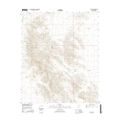
2014 Map of Arch Tank
USGS Topo · Published 2014About this map
Arch Tank Natural Bridge serves as a prominent landmark in this arid portion of Yuma County, where the desert landscape is defined by its seasonal water sources and mining history. The map shows a network of vital tanks, including Horse Tanks, Gray Tanks, and Hollow Rock Tank, which were essential for travelers and miners navigating the arid flats of the La Posa Plain. In the south, the topography rises toward McPherson Pass, a natural corridor between the desert basins.
Find a feature on this map
26 named features on this map. Tap any name to fly to it.
Don’t see what you’re looking for? This feature index may not catch every label — zoom into the map to look around manually.
Map Details
Editions of this 2014 Arch Tank Map
This is the sole edition of this map. No revisions or reprints were ever made.
Other maps of this area

1934 · Trigo Peaks
USGS Topo · 1:48,000

1939 · Red Hill
USGS Topo · 1:62,500

1939 · Trigo Peaks
USGS Topo · 1:62,500

1942 · Blythe
USGS Topo · 1:250,000

1954 · Salton Sea
USGS Topo · 1:250,000

1954 · Red Hill
USGS Topo · 1:62,500

1954 · Trigo Peaks
USGS Topo · 1:62,500

1955 · Salton Sea
USGS Topo · 1:250,000

1959 · Salton Sea
USGS Topo · 1:250,000
1962 · Livingston Hills
USGS Topo · 1:62,500