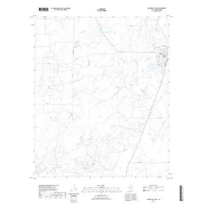
2019 Map of Archer City West
USGS Topo · Published 2019About this map
The western edges of Archer City and the surrounding Texas ranching country are defined by the winding paths of the Middle Fork Little Wichita River and the S Fork Little Wichita River. In this 2019 survey, the landscape is a network of rural roads and water courses, where local thoroughfares like Devils Drop Rd and Tanner Rd navigate the rolling terrain toward the county seat. The town's western residential grid is clearly visible, showing the transition from the structured streets of W Main St and W South St into the open pastureland and drainage basins of Dogwood Cr and Onion Cr. Water management is central to the area's geography, anchored by significant bodies such as Carver Lake and Ikard Lake, which support the agricultural needs of the North Texas plains.
Find a feature on this map
35 named features on this map. Tap any name to fly to it.
Don’t see what you’re looking for? This feature index may not catch every label — zoom into the map to look around manually.
Map Details
Editions of this 2019 Archer City West Map
This is the sole edition of this map. No revisions or reprints were ever made.
Other maps of this area

1931 · Archer City
USGS Topo · 1:62,500

1932 · Dundee
USGS Topo · 1:62,500

1954 · Wichita Falls
USGS Topo · 1:250,000

1958 · Wichita Falls
USGS Topo · 1:250,000
1963 · Archer City NE
USGS Topo · 1:24,000

1963 · Archer City East
USGS Topo · 1:24,000

1964 · Bobcat Bluff
USGS Topo · 1:24,000

1964 · Dundee SE
USGS Topo · 1:24,000

1964 · Archer City West
USGS Topo · 1:24,000
1964 · Prickly Pear Branch
USGS Topo · 1:24,000