
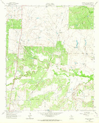
1963 Map of Archer City East
USGS Topo · Published 1964About this map
Archer City serves as the focal point for this North Texas landscape, where the petroleum industry and cattle country intersect. Surveyed in the early 1960s, the map reveals a terrain heavily shaped by oil exploration, with the King Wilson Oil Field and the North Archer City Oil Field surrounding the town. A network of unimproved dirt roads and light-duty paths connects dozens of active Oil Wells across the rolling topography, while the local infrastructure includes a Hospital and Sewage Disposal plant. The drainage of the area is defined by Onion Creek and its tributary, Little Onion Creek, which meander through open fields and wooded clusters. This sheet provides a detailed look at the rural economy of Archer County before modern suburban expansion, documenting specific field names like the Barbara Oil Field and Gore Oil Field.
Find a feature on this map
20 named features on this map. Tap any name to fly to it.
Don’t see what you’re looking for? This feature index may not catch every label — zoom into the map to look around manually.
Map Details
Editions of this 1963 Archer City East Map
This is the sole edition of this map. No revisions or reprints were ever made.
Other maps of this area

1931 · Archer City
USGS Topo · 1:62,500

1954 · Wichita Falls
USGS Topo · 1:250,000

1958 · Wichita Falls
USGS Topo · 1:250,000

1962 · Windthorst
USGS Topo · 1:24,000

1963 · Scotland
USGS Topo · 1:24,000
1963 · Archer City NE
USGS Topo · 1:24,000

1964 · Bobcat Bluff
USGS Topo · 1:24,000

1964 · Darnell Branch
USGS Topo · 1:24,000

1964 · Archer City West
USGS Topo · 1:24,000
1964 · Prickly Pear Branch
USGS Topo · 1:24,000