
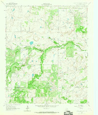
1964 Map of Darnell Branch
USGS Topo · Published 1967About this map
The confluence of rural drainage patterns and early oil development characterizes this North Texas landscape during the early 1960s. The meandering course of the West Fork Trinity River dominates the central terrain, fed by tributaries like Darnell Branch and Brushy Creek. This era reveals a transition from traditional ranching to industrial utility, evidenced by the presence of a prominent pipeline and specialized energy sites such as Burns-Jones Field and Prideaux Field.
Find a feature on this map
16 named features on this map. Tap any name to fly to it.
Don’t see what you’re looking for? This feature index may not catch every label — zoom into the map to look around manually.
Map Details
Editions of this 1964 Darnell Branch Map
This is the sole edition of this map. No revisions or reprints were ever made.
Other maps of this area

1931 · Archer City
USGS Topo · 1:62,500

1954 · Wichita Falls
USGS Topo · 1:250,000

1958 · Wichita Falls
USGS Topo · 1:250,000

1962 · Windthorst
USGS Topo · 1:24,000

1962 · Antelope Creek NE
USGS Topo · 1:24,000

1963 · Archer City East
USGS Topo · 1:24,000

1964 · Loving
USGS Topo · 1:24,000

1964 · Lynn Creek
USGS Topo · 1:24,000

1964 · Antelope
USGS Topo · 1:24,000
1964 · Prickly Pear Branch
USGS Topo · 1:24,000