
1964 Map of Antelope
USGS Topo · Published 1967About this map
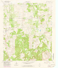
Antelope sits at the intersection of several regional routes in the northwestern portion of Jack County, serving as a focal point for a landscape defined by ranching and petroleum extraction in the mid-1960s. The northern reaches of the map are dotted with activity in the McKinlay and Shannon areas, where an extensive Oil Field is marked by a network of wells and a major pipeline. This energy infrastructure shares the terrain with the headwaters of the West Fork Trinity River, which carves through the southern half of the quadrangle alongside Cameron Creek and Postoak Creek. Topographic variety is provided by prominent rises like Backbone Mountain and Mount Lebo, while the Antelope Cem offers a primary point of interest for genealogists tracing local families. The map also captures the Clay County and Jack County line, documenting the rural character of this North Texas region before modern expansion.
Find a feature on this map
20 named features on this map. Tap any name to fly to it.
Don’t see what you’re looking for? This feature index may not catch every label — zoom into the map to look around manually.
Map Details
Editions of this 1964 Antelope Map
2 editions found
Other maps of this area

1954 · Wichita Falls
USGS Topo · 1:250,000

1958 · Wichita Falls
USGS Topo · 1:250,000

1962 · Windthorst
USGS Topo · 1:24,000

1962 · Antelope Creek NE
USGS Topo · 1:24,000

1964 · Johnson Lake
USGS Topo · 1:24,000

1964 · Darnell Branch
USGS Topo · 1:24,000

1964 · Lynn Creek
USGS Topo · 1:24,000

1964 · Scotland SE
USGS Topo · 1:24,000
1964 · Postoak
USGS Topo · 1:24,000
1964 · Markley
USGS Topo · 1:24,000